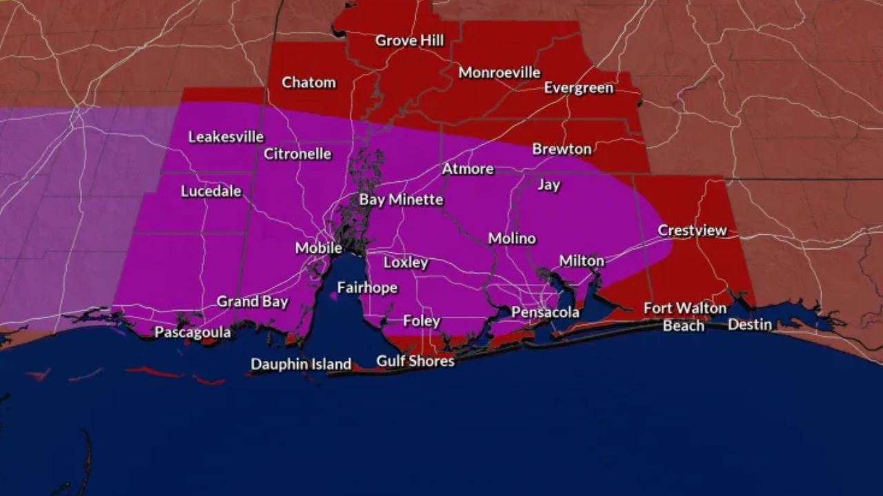
LOCAL NEWS – A First Alert is officially in effect this afternoon and evening as an approaching cold front threatens to bring damaging winds, torrential downpours, and isolated tornadoes to the area.
Timing and Main Threats
The First Alert window runs from 3:00 p.m. to 11:00 p.m. today, Monday. While a few scattered severe thunderstorms could develop during the midafternoon, weather officials warn that the greatest danger will arrive during the evening hours.
High moisture levels ahead of the cold front are fueling the system, creating a setup for:
- Damaging wind gusts capable of bringing down trees and power lines.
- Torrential downpours that could trigger sudden flash flooding.
- An isolated tornado threat as storms become more widespread tonight.
Monday’s high temperature is expected to top out at 85° before the storms move in.
Midweek Improvement
Showers will begin to diminish overnight, but the cold front will move slowly through the region on Tuesday. Residents can expect some lingering scattered showers during the day on Tuesday, with late-day sunshine. No severe weather is expected tomorrow, and temperatures will cool down to a comfortable 80°.
Wednesday and Thursday look to be beautiful June days, featuring partly to mostly sunny skies, low humidity, and highs remaining in the 80s.
Weekend Outlook
The relief will be temporary, as the threat of showers and thunderstorms is tracking to return by Friday and last into the first half of the weekend.