CHICAGO, IL – A second round of severe thunderstorms is threatening the Chicago area and northwest Indiana tonight, just hours after intense morning storms knocked out power to over 70,000 residents and flooded holiday events.
Midnight Storm Watch and Flash Flood Warnings
The National Weather Service (NWS) has issued a Severe Thunderstorm Watch until 2:00 a.m. CT, covering virtually the entire Chicago metropolitan area. The heaviest threat is expected to target the Interstate 88 and I-290 corridors in northern Illinois.
Additionally, a flash flood warning in Cook County was upgraded to “significant,” triggering emergency alerts on residents’ cell phones. The highest rainfall totals are expected near Harvey, Country Club Hills, and Homewood, where previous downpours already dropped 3 to 5 inches of rain.
The following counties remain under a severe storm watch:
- Illinois: Cook, Will, Grundy, Kankakee
- Indiana: Lake, Porter, Jasper, Newton
Widespread Damage and Tragic Capsizing
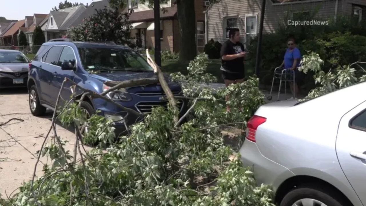
The early morning system left a trail of destruction across the region. High winds downed massive trees and power lines, forcing several suburbs to cancel their official Fourth of July festivities.
The severe weather also turned tragic in nearby Lake Geneva, where a boat capsized during the storm. Officials confirmed three people died and seven others were rescued. Local emergency resources in the area have been overwhelmed at an “unprecedented” rate due to scattered trees and damaged structures.
Holiday Weekend Forecast
Meteorologists warn that because the ground is already completely saturated, any new rainfall will immediately trigger flash flooding. The main threats tonight remain damaging winds, torrential downpours, and frequent lightning.
While a brief dry spell is expected Saturday morning, another weather system could roll in by early Saturday afternoon, potentially disrupting remaining Fourth of July holiday plans. Residents are urged to have multiple ways to receive warning updates tonight.