DETROIT, MI – Southeast Michigan faces a risk of severe weather Friday evening as a incoming storm system targets the region, bringing an end to days of intense heat.
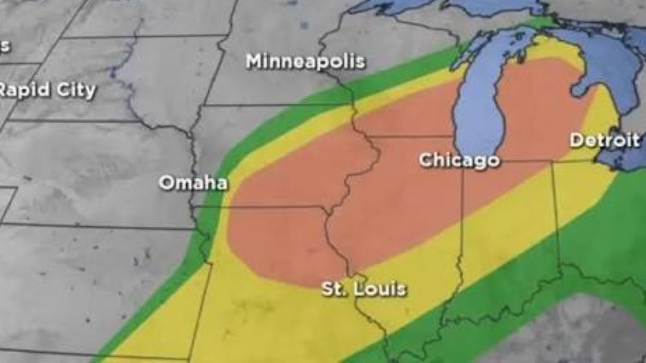
Severe Storm Risk Matrix
The Storm Prediction Center has placed southern Michigan counties under a Level 2 out of 5 risk category for strong-to-severe storms. The primary window for these storms to develop is Friday afternoon through the late evening hours.
Local residents should prepare for potential hazards, including:
- Heavy, torrential rainfall leading to localized street flooding.
- Strong, damaging wind gusts capable of downing tree branches.
- Large hail that could impact vehicles and property.
Weekend Cooling Relief
Once the Friday evening storm front clears, a much-anticipated temperature drop will arrive for the weekend. The oppressive heat will break, making way for much more comfortable, seasonal conditions across the region.
Statewide Travel Weather
For those planning weekend travel across Michigan, conditions will vary significantly by region:
- The Lower Peninsula: Rain chances will persist through both Saturday and Sunday, with the heaviest focus initially staying across southern areas before shifting north.
- The Upper Peninsula: Following several days of severe weather earlier in the week, the U.P. will finally dry out. Temperatures will turn significantly cooler, dropping into the 60s near Lake Superior and the 70s along the southern shore.
Residents are advised to monitor local radar updates before traveling or attending outdoor evening activities on Friday.