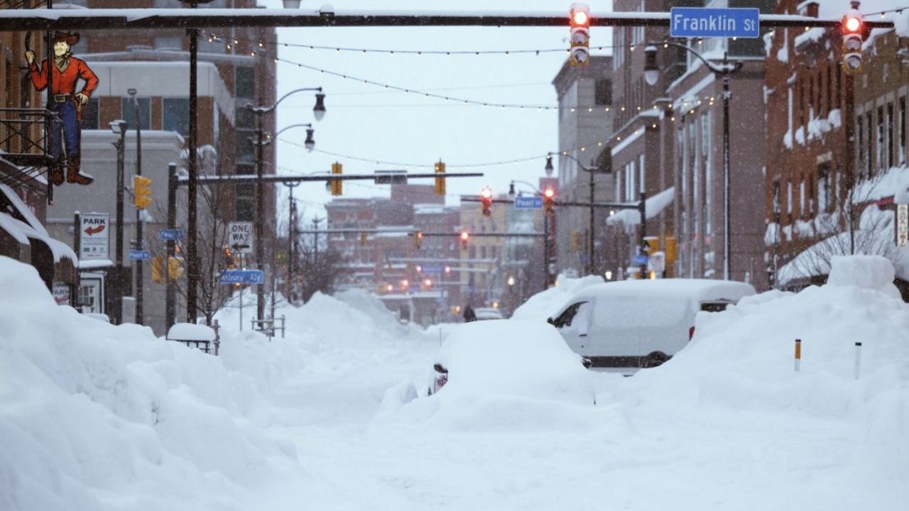
Buffalo, New York – A prolonged winter storm is expected to bring widespread snow, icy roads, and dangerous travel conditions across western and central New York from late Wednesday through early Friday morning, with some lake-effect areas potentially seeing up to 10 inches of snow.
Forecasters say a transition from rain to snow Wednesday evening, followed by persistent lake-effect bands, will create rapidly changing conditions across the region. Multiple Winter Weather Advisories are in effect, with the highest impacts expected east of Lakes Erie and Ontario.
Incident Overview
The storm system moving through the Great Lakes is drawing colder air into the region, allowing rain to quickly change over to snow after sunset Wednesday. As temperatures drop below freezing, untreated roads are expected to become slick, particularly during the Wednesday night and Thursday morning commutes.
According to guidance from the National Weather Service, the combination of synoptic snow and lake-effect enhancement will prolong snowfall into Friday morning in some areas, increasing total accumulations and travel risks.
Timeline of Events
Snow is expected to begin impacting western New York late Wednesday afternoon, with rain changing to snow by early evening in most locations. Accumulations will continue overnight into Thursday as colder air deepens.
Lake-effect snow bands are forecast to strengthen Thursday afternoon, particularly east and southeast of Lake Ontario, persisting into the overnight hours and gradually tapering Friday morning. Advisories may be extended if snow lingers longer than expected.
Details From Weather Officials
Meteorologists warn that falling temperatures will cause snow to accumulate quickly on roadways, even where rain initially falls.
“As colder air moves in Wednesday evening, conditions will deteriorate rapidly, with slick roads and reduced visibility,” forecasters noted in a winter briefing issued by the National Weather Service forecast office.
Wind chills are also expected to become a concern, with some areas experiencing below-zero wind chill values, increasing the risk of frostbite for those exposed outdoors for extended periods.
Key Snowfall Totals by Region
Most of western New York, including Buffalo, Niagara Falls, Rochester, Batavia, and Wellsville, can expect 3 to 6 inches of snow through Thursday.
Higher snowfall amounts are likely in several regions:
• Wayne and northern Cayuga counties – 5 to 10 inches
• Tug Hill Plateau – up to 10 inches
• Oswego, Jefferson, and Lewis counties – locally higher totals
• Southern Tier, including Jamestown, Olean, Springville, and Warsaw – 5 to 10 inches, especially in elevated terrain such as the Chautauqua Ridge and Boston Hills
Localized lake-effect bands may lead to sharp differences in snowfall totals over short distances.
Travel and Safety Concerns
Transportation officials warn that travel may become hazardous, particularly during peak commuting hours. Reduced visibility, snow-covered roads, and icy patches are expected, especially overnight and early morning.
“Drivers should slow down, increase following distance, and be prepared for rapidly changing conditions as lake-effect bands shift,” officials advised.
Motorists are encouraged to keep emergency kits in vehicles, including blankets, food, water, and flashlights, in case of delays or road closures.
Additional Context: Lake-Effect Snow Risks
Lake-effect snow events are especially dangerous because snowfall intensity can increase suddenly. Areas under a persistent band may see several inches fall in just a few hours, overwhelming plow operations and making roads impassable.
Residents near Lake Erie and Lake Ontario are urged to closely monitor local forecasts, as small wind shifts can move heavy snow bands into new areas with little warning.
Conclusion
This long-duration winter storm is expected to significantly impact western and central New York through Friday morning, with the greatest snowfall totals focused in lake-effect prone regions. Travelers and residents should prepare for hazardous road conditions, cold wind chills, and possible advisory extensions.
If you are in an affected area, consider delaying non-essential travel and staying updated with the latest local forecasts. Share your experiences in the comments below.