Boston, Massachusetts — Residents across Massachusetts and southern New England are preparing for a wet and potentially disruptive Thursday as a slow-moving storm system brings periods of heavy rain, possible flooding, and difficult travel conditions before a dramatic warm-up arrives this weekend.
Forecasters warn that while rain may not fall continuously throughout the day, intense downpours could develop quickly in some areas and create hazardous conditions.
Heavy Rain Expected During Morning Commute
Meteorologists say the greatest concern Thursday morning will be a slow-moving band of heavy rain expected to move through central and eastern Massachusetts during the commute hours.
Drivers could face reduced visibility, ponding water on roadways, and delays as bursts of torrential rain move across the region.
Weather experts noted that this setup appears to be one where “when it is raining, it is pouring,” meaning rainfall could become extremely intense over short periods of time.
By midday, the heaviest rain band is expected to gradually shift eastward, placing coastal communities under the highest threat for downpours.
Conditions Will Vary Across the Region
Thursday afternoon and evening are expected to bring highly variable weather conditions depending on location.
Some communities may continue seeing lingering downpours, while others could experience breaks of partial sunshine as the storm system slowly shifts offshore.
This type of unsettled weather pattern often creates rapidly changing conditions, making forecasts more challenging and increasing the possibility of isolated heavier rainfall pockets.
Meteorologists say residents should remain alert for sudden weather changes throughout the day.
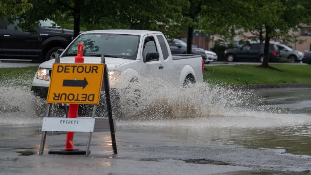
Localized Flooding Possible in Some Areas
Rainfall totals are expected to differ significantly from town to town across southern New England.
Most areas are forecast to receive between 0.5 and 1 inch of rain, but isolated locations caught under stronger downpours could pick up between 1 and 3 inches.
Forecasters warn that if rainfall totals exceed 1 inch in a short amount of time, localized flooding may develop, particularly in urban areas, low-lying neighborhoods, and near smaller streams.
The greatest flooding concerns are expected in locations where repeated rounds of heavy rain occur over the same area.
Residents are being advised to avoid driving through flooded roadways and to monitor local weather alerts closely during the storm.
Friday Forecast Looks Gray and Chilly
By Friday, the center of the storm system is expected to move offshore, but much of southern New England will still remain trapped within the storm’s broader circulation pattern.
As a result, forecasters expect a gloomy day featuring:
- Cloudy skies
- Periods of drizzle and scattered showers
- Cool north-northeast winds
Temperatures will remain noticeably cooler compared to the upcoming weekend, creating a sharp contrast in weather conditions over just a couple of days.
Dangerous Weather Pattern Targets Central U.S. With Damaging Winds and Large Hail
Some clearing may finally arrive late Friday evening around sunset.
Warmest Weekend Since October Ahead
After the gloomy stretch, a dramatic warm-up is expected to take over the region beginning Saturday.
Meteorologists say temperatures will surge into the 70s and even 80s across parts of southern New England and remain unusually warm through the middle of next week.
In fact, forecasters say this upcoming weekend could become the warmest weekend in the Boston area since early October.
The rapid temperature swing will bring a much more summer-like feel to the region after several days of rain and chilly conditions.
Residents are being encouraged to enjoy the warmer weather while also staying aware of changing forecast conditions as the transition unfolds.
Are you ready for the dramatic weather swing from flooding rain to summer-like warmth? Share your thoughts in the comments below.