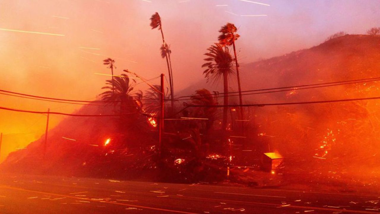
Los Angeles, California: Southern California is preparing for a prolonged and potentially dangerous wind event beginning Wednesday afternoon, with forecasters warning of damaging gusts, power outages, hazardous travel conditions, and even a slight chance of snow over higher elevations.
According to the National Weather Service, a multi-day wind pattern will impact Los Angeles and surrounding counties, intensifying into a stronger Santa Ana wind event by Friday and Saturday.
What to Expect This Week in Southern California
A northerly wind event will begin developing Wednesday afternoon, primarily affecting mountain areas and north-south travel corridors such as Interstate 5.
Wind gusts of 35 to 50 mph are expected initially, especially in:
- Antelope Valley
- Santa Clarita Valley
- San Fernando Valley
- Mountain passes and high-risk corridors
By Friday and Saturday, a stronger Santa Ana event could push gusts even higher.
Forecasters indicate a 40% chance of 60–70 mph gusts in the Western San Gabriel and Santa Susana mountains during peak intensity.
Wind Advisories in Effect
The National Weather Service has issued wind advisories beginning as early as 4 p.m. Wednesday for several valley communities, including:
- San Fernando Valley
- Santa Clarita
- Agoura Hills
- Antelope Valley
Officials warn that damaging gusts may down trees, cause power outages, and create dangerous crosswinds on major highways.
Timeline of the Wind Event
Here is a breakdown of what residents can expect:
Wednesday Afternoon
Northerly winds begin developing across mountain regions and the Antelope Valley.
Wednesday Evening (Around 6 p.m.)
Wind advisories take effect for valley communities.
Thursday Morning
Snow levels drop to approximately 4,000 feet, bringing a 10%–20% chance of light snow over the Grapevine along Interstate 5.
Friday Morning
A stronger Santa Ana wind event ramps up.
Saturday
Peak intensity expected, with gusts possibly reaching 70 mph in higher-risk mountain corridors.
Sunday into Monday
Gradual weakening of winds, though lighter Santa Ana conditions may persist into early next week.
Travel and Infrastructure Concerns
Meteorologists are emphasizing the potential impact on transportation and infrastructure.
The wind orientation could create hazardous crosswinds on major freeways, particularly:
- Interstate 5
- Highway 33
- Mountain passes
High-profile vehicles such as trucks, vans, and SUVs are especially vulnerable during peak gust periods.
Air travel may also be affected. Officials warn of possible delays at:
- Los Angeles International Airport
- Hollywood Burbank Airport
Travelers are advised to monitor airline updates for schedule changes.
Temperature Changes and Snow Potential
While coastal and valley temperatures are expected to remain in the 60s and low 70s, colder air following the gusts will cause a noticeable drop in mountain temperatures.
Snow levels could fall to 4,000 feet early Thursday morning, bringing a small but notable chance of light snowfall over the Grapevine — a key mountain pass connecting Southern and Central California.
Although accumulation is expected to be minimal, even light snow could cause temporary travel issues.
How to Prepare
Residents are encouraged to take precautions ahead of the strongest winds:
- Secure outdoor furniture, trash bins, and umbrellas
- Park vehicles away from trees if possible
- Avoid driving high-profile vehicles through wind-prone corridors during peak gust times
- Charge electronic devices in case of power outages
- Monitor official weather alerts and updates
Conclusion
Southern California faces a multi-day wind event that will intensify into a moderate to strong Santa Ana pattern by the weekend. With gusts potentially reaching 70 mph in mountain areas, the risk of downed trees, power outages, and travel disruptions is significant.
Residents across Los Angeles County and surrounding regions are urged to stay alert, prepare ahead of time, and closely follow official updates as the situation develops.