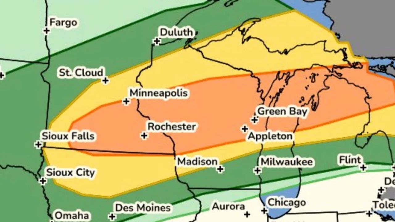
MINNEAPOLIS, MN – Twin Cities residents should prepare for a sudden shift in weather Tuesday night as a wave of potentially severe thunderstorms threatens to break up a day of intense heat and humidity.
Timing the Storms
While Tuesday will start hot and sunny with high temperatures climbing into the upper 80s, conditions are expected to deteriorate quickly after sunset.
According to weather forecasts, clouds will begin streaming in from the west ahead of the system, with the primary threat window for the metro area opening around 8:00 p.m. Tuesday night.
Primary Threats: Wind and Hail
The incoming storm system brings a risk of severe weather. Local residents should secure loose outdoor items and prepare for:
- Damaging wind gusts
- Localized hail
- Frequent lightning and heavy downpours
A few lingering showers and thunderstorms may stick around into Wednesday morning before the system fully clears the region.
Extended Outlook: A Prolonged Hot Stretch Ahead
Once the midweek storms pass, conditions will gradually improve. Dry, pleasant weather is expected to return for the remainder of the week, bringing seasonable summer temperatures back to Minnesota.
However, looking ahead to next week, long-range forecasts indicate that heat and humidity will build significantly, creating the potential for a prolonged, multi-day hot stretch across the Twin Cities.
MINNEAPOLIS, MN – Twin Cities residents should prepare for a sudden shift in weather Tuesday night as a wave of potentially severe thunderstorms threatens to break up a day of intense heat and humidity.
Timing the Storms
While Tuesday will start hot and sunny with high temperatures climbing into the upper 80s, conditions are expected to deteriorate quickly after sunset.
According to weather forecasts, clouds will begin streaming in from the west ahead of the system, with the primary threat window for the metro area opening around 8:00 p.m. Tuesday night.
Primary Threats: Wind and Hail
The incoming storm system brings a risk of severe weather. Local residents should secure loose outdoor items and prepare for:
- Damaging wind gusts
- Localized hail
- Frequent lightning and heavy downpours
A few lingering showers and thunderstorms may stick around into Wednesday morning before the system fully clears the region.
Extended Outlook: A Prolonged Hot Stretch Ahead
Once the midweek storms pass, conditions will gradually improve. Dry, pleasant weather is expected to return for the remainder of the week, bringing seasonable summer temperatures back to Minnesota.
However, looking ahead to next week, long-range forecasts indicate that heat and humidity will build significantly, creating the potential for a prolonged, multi-day hot stretch across the Twin Cities.