SIOUX FALLS, S.D. — Spring in KELOLAND has officially arrived with a bang. After a stretch of unseasonably warm temperatures, the first significant threat of severe weather for the 2026 season is moving through the region, putting local residents on high alert.
A potent low-pressure system is currently tracking across southeastern KELOLAND, creating a volatile environment for strong to severe thunderstorms. The primary concern for Monday evening remains large hail and damaging wind gusts, though meteorologists warn that an isolated tornado cannot be entirely ruled out.
Areas Under Watch: Is Your Town at Risk?
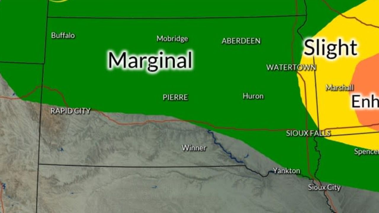
The Storm Prediction Center has issued a “Slight Risk” (Level 2 of 5) for a broad swath of the region. If you live in the following areas, you should have a way to receive weather alerts:
- South Dakota: Grant County, Madison, and the entire SE corner of the state.
- Minnesota: Marshall, Luverne, and Worthington.
- Iowa: All Northwest Iowa communities.
A Severe Thunderstorm Watch remains in effect until 10:00 PM CDT for these areas. A broader “Marginal Risk” extends north of the I-90 corridor and throughout the southern Missouri River Valley.
The Week Ahead: From Warm Sunshine to Snow Showers
While the immediate threat is storms, the rest of the week promises a classic Midwestern roller coaster ride.
Mid-Week Lingering Rain: Showers are expected to stay in the forecast for southeastern KELOLAND through Wednesday. West River residents may also see some light, “low-end” shower activity during this time.
The “Pick Day” of the Week: If you have outdoor plans or yard work, Thursday is your best bet. Forecasters expect a surge of warm temperatures and plenty of sunshine to kick into high gear for central and eastern KELOLAND, providing a brief but beautiful window of spring weather.
A Sharp Turn to Winter: The warmth won’t last. A powerful cold front is slated to arrive on Friday. This system will likely record the day’s “high” temperatures early in the morning before values plummet. By Friday night and into Saturday, rain is expected to transition into rain/snow showers for both East and West River communities.
Safety First
With the first severe weather event of the year, local officials are reminding residents to:
- Check your batteries: Ensure weather radios and flashlights are ready.
- Know your shelter: Identify the lowest, most interior room in your home.
- Secure outdoor items: High winds can turn patio furniture and trash cans into dangerous projectiles.
The weather is expected to quiet down by Sunday and Monday of next week, with a slow warming trend returning to the plains.
How are you preparing for the first storms of the year? Have you already seen hail in your neighborhood? Share your weather photos and updates in the comments below!