CENTRAL U.S. — The FOX Forecast Center and NOAA’s Storm Prediction Center are issuing urgent warnings as a relentless series of storm systems prepares to batter the South and Plains. Forecasters warn that the severe weather won’t let up anytime soon, with a “potentially significant” event expected to peak over the weekend.
From Oklahoma to Minnesota and down into the Mississippi Valley, millions of residents are being urged to finalize their severe weather plans now.
The Timeline: What to Expect and When
Friday: The Mississippi Valley Shift As a cold front pushes across the Plains, moisture and instability will surge.
- Primary Zones: Northeast Texas, Northern Louisiana, and much of Arkansas.
- Risk Level: A Level 2 out of 5 risk is in effect.
- Hazards: Damaging winds and hail are the primary concerns as storms reorganize during the heat of the day.
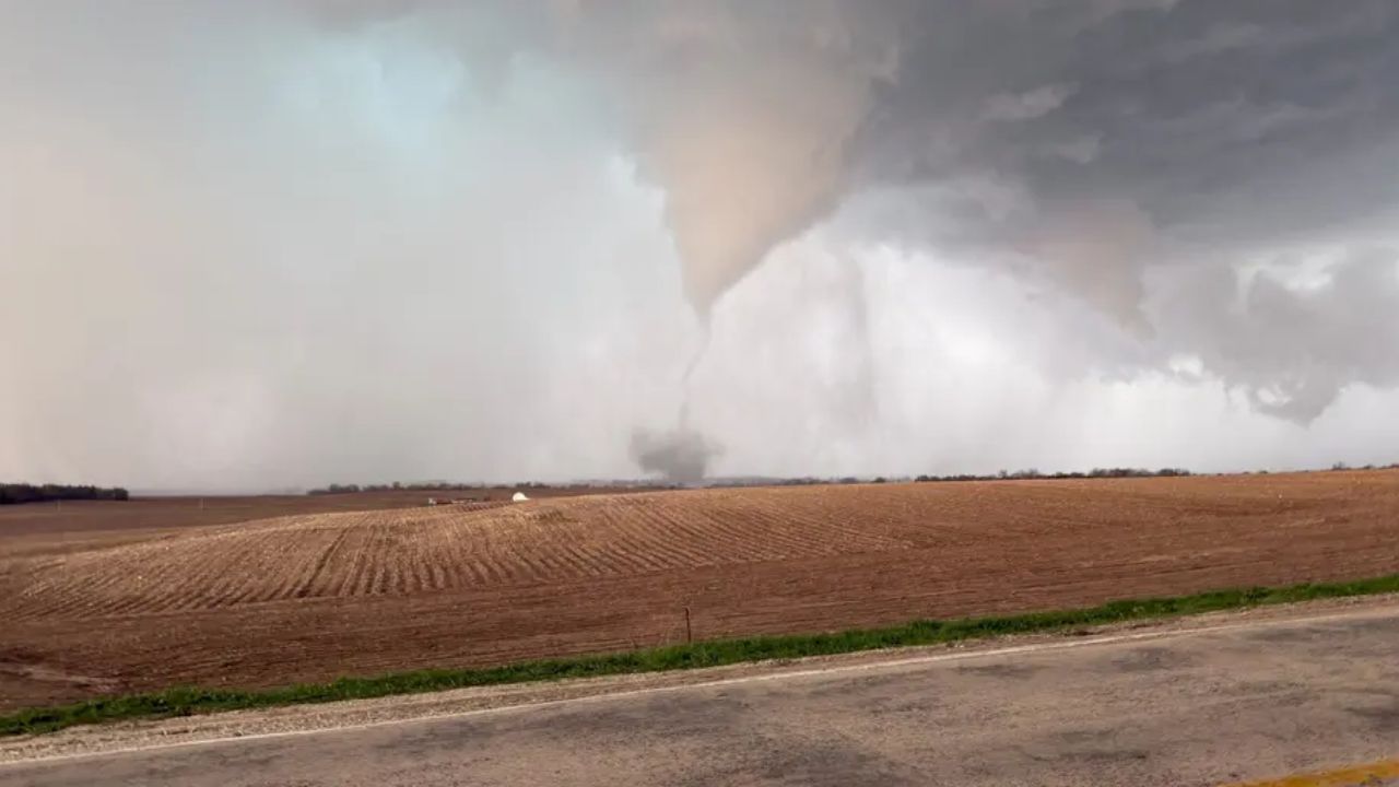
Saturday: Supercells and “All Hazards” in the Plains The threat escalates as a warm front lifts across the Southern Plains, providing the fuel for more dangerous storm structures.
- Primary Zones: Southern Kansas and Northern Oklahoma, including Wichita and Tulsa.
- Risk Level: Elevated to Level 3 out of 5.
- Hazards: Discrete supercells are expected to form in the late afternoon before merging into a line. Forecasters warn that all severe hazards—including tornadoes—are possible.
Sunday: A “Potentially Significant” Event Sunday is shaping up to be the most dangerous day of the stretch. A strong low-pressure system and a sharp “dryline” in Texas will collide with intense moisture and wind shear.
- Primary Zones: Expanding across the Plains and into North Texas.
- Hazards: This setup is favorable for significant severe weather into the evening hours.
Monday Forecast: Mid-South in the Crosshairs
As the workweek begins, the low-pressure system will track eastward. By Monday, the threat shifts into the lower Mississippi Valley and Mid-South. Residents in the following cities should prepare for a messy and potentially dangerous Monday morning commute:
- Memphis, TN
- Nashville, TN
- Jackson, MS
- Birmingham, AL
Safety Checklist for Local Residents
With a multi-day threat, “weather fatigue” can set in. Emergency officials recommend the following:
- Multiple Ways to Get Alerts: Ensure your phone’s Wireless Emergency Alerts (WEA) are turned on and have a battery-operated weather radio.
- Identify Your Shelter: Know exactly where your family will go (basement, storm cellar, or interior room on the lowest floor) before the sirens sound.
- Charge Your Devices: Potential power outages from damaging winds mean you should charge all phones and power banks today.
Stay Weather-Ready, South. How are you preparing for the storms this weekend? Have you noticed a shift in the local forecast for your town?
Share your local weather updates and photos in the comments below to help keep your neighbors informed!