El Dorado County, California — After a series of powerful February storms blanketed parts of Northern California with fresh snow, state water officials say the snowpack has improved — but remains well below average levels for this time of year.
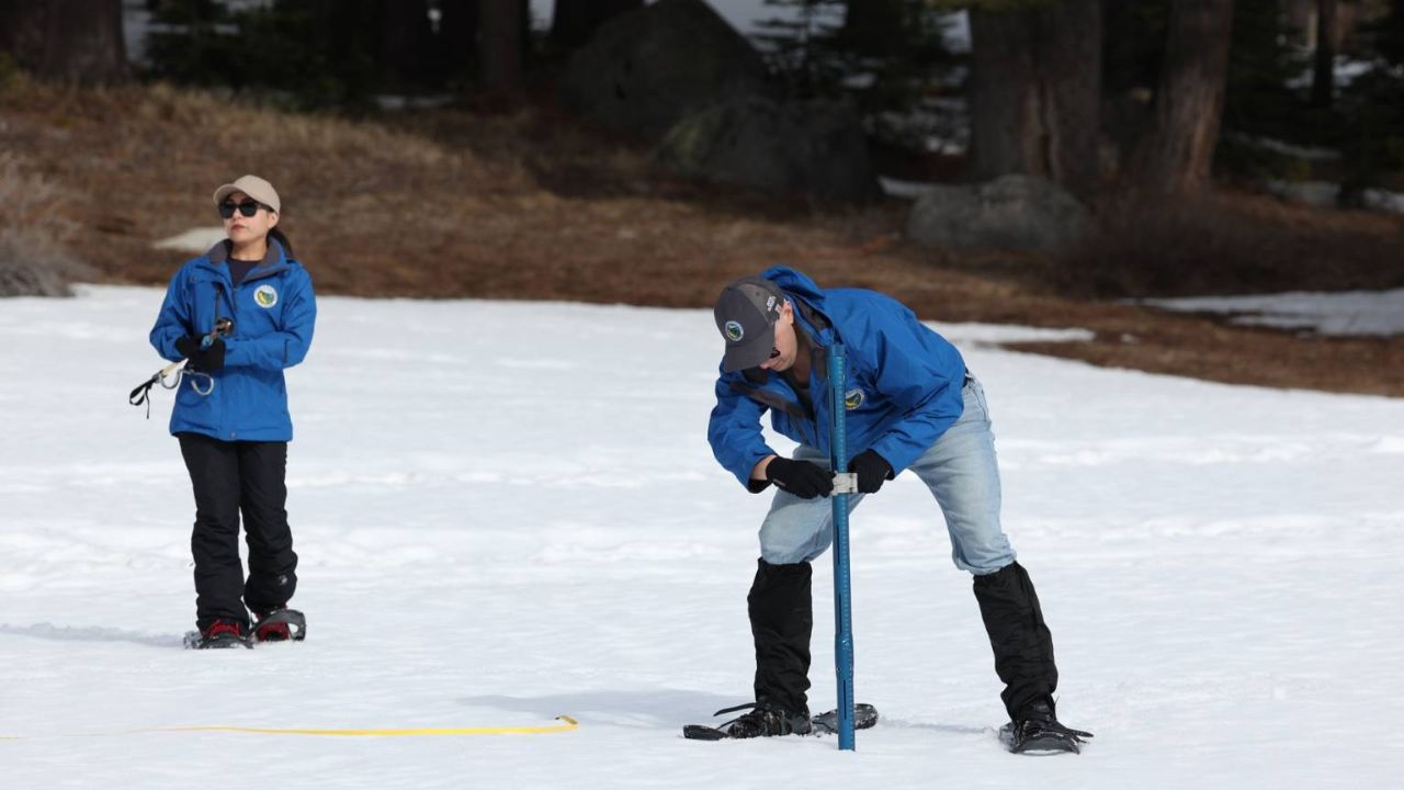
The California Department of Water Resources (DWR) conducted its third snow survey of the season Friday at Phillips Station in El Dorado County. Officials reported that the snowpack at that location measured just 47% of average.
Statewide, California’s snowpack currently stands at 66% of average for this date, according to DWR data.
Storm Boost Follows Five-Week Dry Spell
The latest measurements show improvement compared to January, when prolonged dry conditions significantly reduced snow accumulation. A string of cold, snow-producing storms in mid-February helped boost totals and ended a five-week dry stretch.
However, officials cautioned that the recent storms were not enough to restore the snowpack to normal levels.
“Although the storms we saw in mid-February were some of the coldest and best snow-producing storms we have seen since 2023, they were not enough to get us back to average conditions,” said Andy Reising, manager of DWR’s Snow Surveys and Water Supply Forecasting Unit.
Uneven Snow Distribution Across the Sierra
The DWR emphasized that snowfall has been uneven across the Sierra Nevada range.
- The southern Sierra is sitting at 90% of average for this date.
- The northern Sierra, however, is only at 46% of average.
This imbalance could have long-term implications for water supply distribution as snowmelt feeds rivers and reservoirs in the months ahead.
Climate Patterns Reshaping Water Cycle
State officials also pointed to broader climate trends influencing snowpack variability.
“The dramatic wet-dry swings this winter remind us again that ever-warmer average temperatures have reshaped the California water cycle,” said DWR Director Karla Nemeth. “We must adapt.”
Warmer temperatures can lead to more precipitation falling as rain instead of snow, reducing the amount of water stored naturally in mountain snowpack — a critical resource during California’s dry summer months.
Read Also: Ohio Valley Storm Update March 7-13: Flash Flooding Possible Along the Indiana–Kentucky Border
Reservoir Levels Offer Some Relief
Despite the below-average snowpack, officials noted that reservoir levels remain above average thanks to precipitation from previous wet seasons.
Still, April 1 is traditionally the most important benchmark. That date typically marks the seasonal peak of California’s snowpack, and the next official survey is scheduled for April 1.
Water managers will closely monitor additional storm activity over the coming weeks to determine whether late-season systems can further boost totals.
For now, while the recent storms have provided some relief, officials stress that California’s water outlook remains uncertain heading into the critical spring melt season.
Do you think California’s recent storms are enough to ease long-term drought concerns? Share your thoughts respectfully in the comments below.