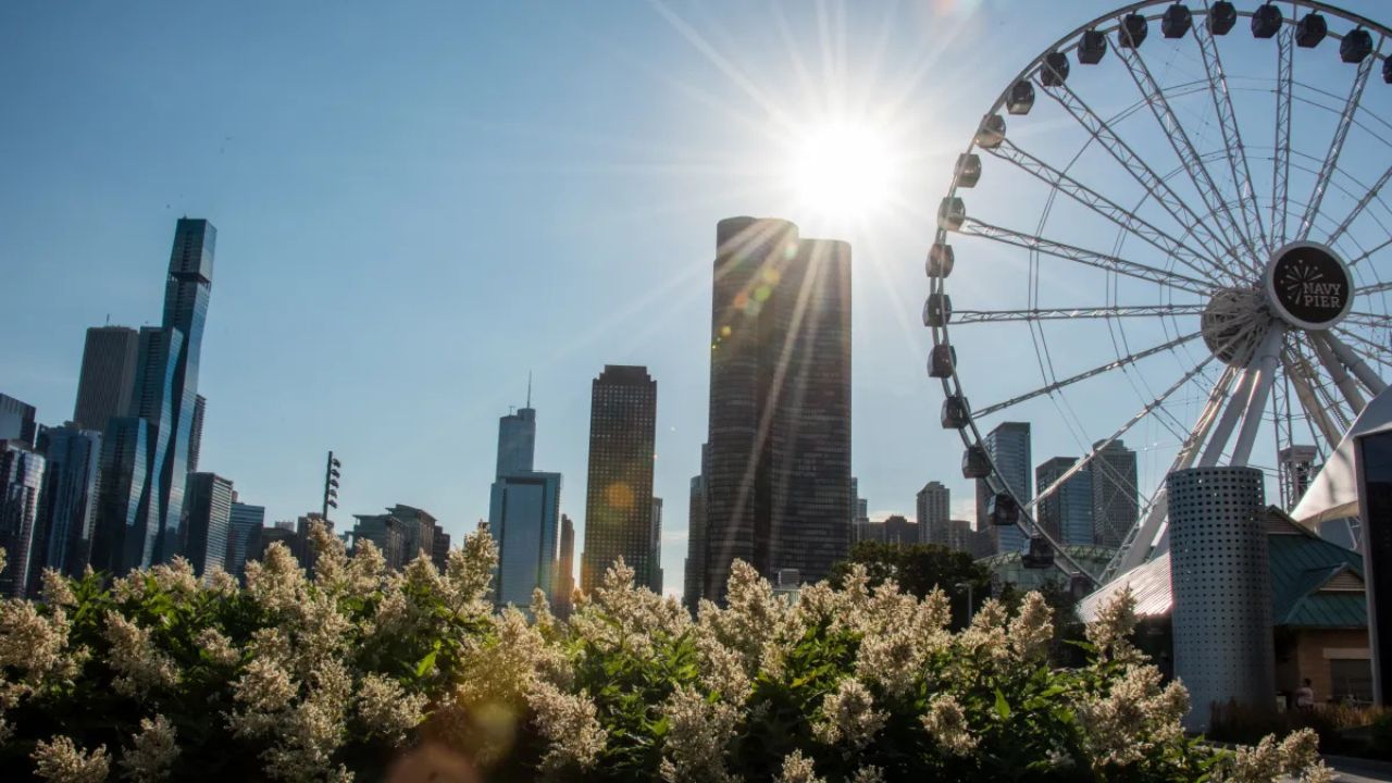
Chicago, Illinois — Chicago residents are set to enjoy an extended stretch of calm and mostly dry weather as meteorologists say a powerful atmospheric pattern is keeping major storm systems away from the region.
After a pleasant start to the week, temperatures are expected to fluctuate noticeably over the coming days, bringing both summerlike warmth and cooler lakefront air to the area.
Warm Temperatures Return to Chicago Area
Following mild and comfortable conditions on Monday, forecasters say Tuesday will bring warmer temperatures despite an increase in cloud cover.
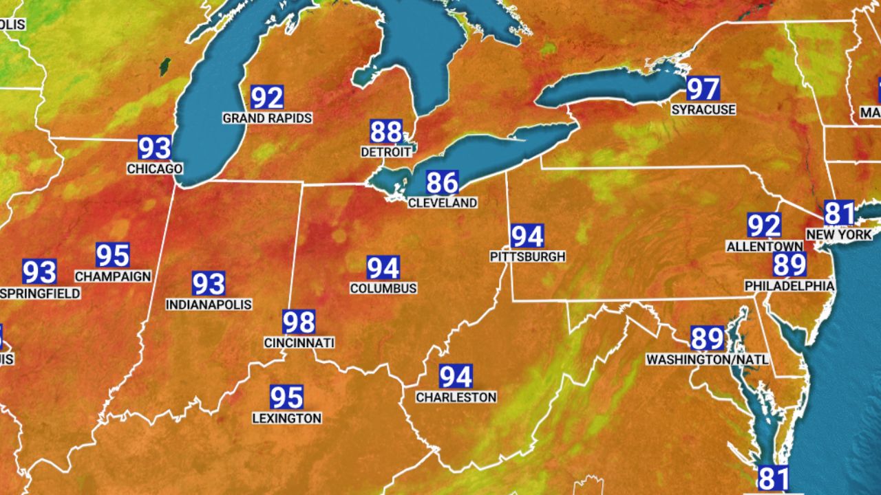
According to the NBC 5 Storm Team, southerly breezes are expected to push afternoon highs into the mid-to-upper 80s, creating temperatures well above seasonal averages for late May.
The warmer pattern is expected to continue through Wednesday, with some clearing skies possible during the day.
Meteorologists say the warmth is being fueled by a weather setup that continues to block major storm systems from entering the Chicago region.
Cool Front to Shift Conditions Later in Week
While warm temperatures will dominate the early part of the week, a cooler air mass is expected to arrive by Thursday.
Forecasters say a cool front moving into the area will bring a noticeable temperature drop, especially for neighborhoods near Lake Michigan.
Although Thursday is still expected to remain mostly sunny, northerly winds could keep lakeside temperatures stuck in the 60s, while inland communities continue experiencing milder readings in the 70s.
The lakefront temperature contrast is common during spring in Chicago, especially when cooler air moves across the colder waters of Lake Michigan.
Dry Weather Pattern Continues
One of the most notable parts of the forecast is the continued lack of rain expected across the region.
Meteorologists say a blocking weather pattern is currently dominating much of the central United States, preventing storm systems from moving directly through Chicago.
Instead, the jet stream is steering weather disturbances away from the area.
Flagler County’s Busy Bing’s Landing Boat Ramp Closing Just as Summer Boating Season Begins
According to forecasters, storm systems are being pushed north toward Canada and the upper Great Plains, while additional rain-producing systems are moving south toward the southeastern United States.
As a result, Chicago is expected to remain largely dry through the rest of the week and potentially into next week as well.
Sunshine and Comfortable Temperatures Expected Into June
Forecast models currently show temperatures remaining mostly in the 70s through the end of May, accompanied by partly sunny to mostly sunny skies.
The calmer weather pattern is expected to continue through the upcoming weekend, offering favorable conditions for outdoor activities, travel and holiday gatherings.
While isolated clouds and brief temperature swings are possible, meteorologists say there are currently no major threats of significant rainfall in the extended forecast.
The prolonged stretch of stable weather comes as many parts of the country continue dealing with stronger storms, severe weather and repeated rounds of heavy rain.
For Chicago residents, however, the upcoming days appear set to bring a relatively peaceful weather pattern with comfortable temperatures and plenty of sunshine.
What do you think about Chicago’s extended stretch of calm weather? Share your thoughts in the comments below.