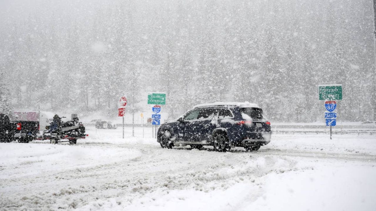
SIERRA NEVADA, CA — Spring may have officially started on the calendar, but Mother Nature has other plans for Northern California this weekend. A massive, mature low-pressure system currently churning off the Pacific coast is set to move inland on Friday, bringing a brutal “pattern change” that will dump several feet of snow across the Sierra Mountains.
The National Weather Service (NWS) has issued a stern Winter Storm Warning, effective through Sunday night, advising residents and travelers that conditions will likely become “very difficult to impossible.”
A Major Shift in Weather Patterns
After a brief taste of milder weather, the region is bracing for a significant atmospheric event. This incoming system is characterized by widespread rain, isolated thunderstorms, and heavy mountain snow that will stretch across California and the Great Basin, eventually reaching the Northern Rockies by Saturday.
“Significant snowfall accumulations are expected for the Sierra Nevada at higher elevations,” the National Weather Service stated. As temperatures plummet, the rain-to-snow line will drop, catching many off guard who had already begun preparing for spring.
Snow Totals: Who Will Be Hit the Hardest?
The forecast is particularly daunting for Western Plumas County, Lassen Park West Slope, and the Northern Sierra Nevada. Local cities including Quincy, Blue Canyon, and Chester are in the direct path of the heaviest accumulation.
The NWS breakdown of the expected snowfall is as follows:
- Above 4,500 feet: 1 to 2 feet of total snow accumulation.
- Highest Peaks: A massive 3 to 4 feet of snow is possible.
- Down to 4,000 feet: Minor accumulations of 2 to 4 inches.
Accompanying the snow will be powerful winds, with gusts expected to reach up to 55 mph in certain areas, creating “whiteout” conditions where visibility could drop to near zero instantly.
Travel Warning: “Delay All Travel”
For those planning a weekend getaway or a commute through the mountains, authorities have a clear message: Don’t.
Up to 24 inches of snow is specifically forecast for Madera and Mariposa Counties, as well as Yosemite National Park above the 7,000-foot mark. Given the combination of heavy snow and dangerous wind gusts, the NWS has issued a rare and urgent plea to the public.
“Persons should delay all travel if possible,” the NWS warning read. “If travel is absolutely necessary, drive with extreme caution and be prepared for sudden changes in visibility.”
Officials are reminding motorists who must be on the road to leave significant space between vehicles and to carry emergency supplies, including chains, blankets, and extra food.
The Economic and Safety Impact
Beyond travel disruptions, the storm poses a risk to local infrastructure. High winds combined with heavy, wet snow can lead to downed power lines and fallen trees, potentially causing outages in rural mountain communities.
LFRS and local emergency teams are on standby, but the sheer volume of snow expected in a short window (Friday evening through Sunday) means that snow removal crews will be working around the clock just to keep main arteries open.
Are you in the path of the storm? How are you preparing for this late-season blast of winter? If you have photos of the snowfall in your area, share them in the comments below! Stay safe and stay tuned for live updates.