Altoona, Pennsylvania — Central Pennsylvania residents are preparing for a sharp weather swing this week as cooler temperatures, rain, and gusty winds move through the region before a dramatic warm-up arrives over the weekend.
Forecasters say the unsettled conditions will continue through Thursday before sunshine and above-average temperatures return heading into next week.
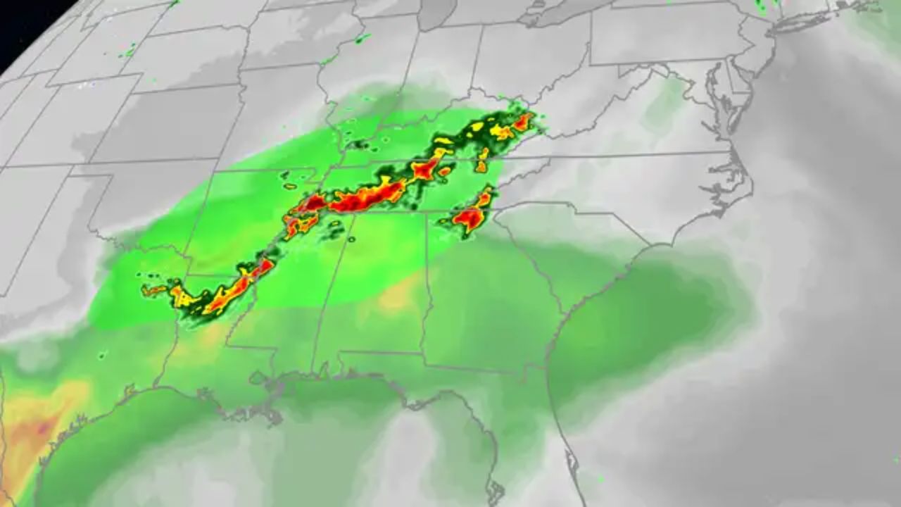
Rain and Thunderstorms Move Into Central PA
Wednesday’s forecast calls for periods of rain during the morning hours, followed by the chance for isolated showers and thunderstorms into the afternoon and evening as a cold front pushes through the region.
Temperatures are expected to remain steady in the 60s for much of the day despite the cloudy and damp conditions.
Weather officials say the best opportunity for thunderstorms will develop during the late afternoon and early evening hours.
The Storm Prediction Center (SPC) has placed all of Central Pennsylvania under a Marginal Risk (1 out of 5) for stronger thunderstorms capable of producing gusty winds.
Although severe weather is not expected to become widespread, residents are still being encouraged to remain alert for rapidly changing conditions during the evening commute.
Cooler Air Arrives Thursday
As the cold front exits the area, winds will shift out of the northwest heading into Thursday, bringing noticeably cooler temperatures across the region.
Thursday is expected to stay mostly cloudy and damp, with high temperatures struggling to reach the mid-50s.
Forecasters also warn that northwest wind gusts between 15 and 25 MPH could make conditions feel even cooler throughout the day.
Light showers and drizzle may linger at times, keeping roads wet and skies gray through much of Thursday afternoon.
Overnight conditions will remain mostly cloudy with temperatures dropping into the 40s.
Sunshine Returns Friday
After several gloomy days, weather conditions are expected to improve heading into Friday.
Cloud cover will gradually decrease, allowing afternoon sunshine to return across Central Pennsylvania. High temperatures are forecast to rebound into the mid to upper 60s, bringing slightly milder conditions closer to seasonal averages.
Winds, however, are expected to remain somewhat breezy out of the northwest.
Friday night should stay partly cloudy with overnight lows settling into the mid-40s.
Weekend Warm-Up Brings Spring-Like Feel
The biggest weather story arrives this weekend as a strong warming trend develops across the region.
Forecasters expect temperatures to climb into the 70s on Saturday, with even warmer conditions arriving Sunday when highs could reach the low 80s in some locations.
Weather Alert: Boston Area Faces Soaking Rain and Flood Risk Ahead of 80-Degree Weekend
The combination of sunshine and warmer air is expected to provide a much more spring-like atmosphere after several cooler days.
There is still a slight chance for a passing shower or thunderstorm Saturday afternoon, but widespread severe weather is not currently anticipated.
Above-Average Temperatures Continue Into Next Week
Meteorologists say the warming trend is expected to continue beyond the weekend, with above-average temperatures likely remaining in place through much of next week.
After dealing with chilly mornings, clouds, and rain earlier in the week, many residents may finally get a chance to enjoy more comfortable outdoor conditions.
Forecasters are encouraging residents to keep an eye on updates as conditions evolve, especially regarding any isolated weekend storm chances.
Are you ready for the warmer weather returning to Pennsylvania? Share your thoughts and weekend plans in the comments below.