NEW YORK CITY, NY — Forecasters have issued a First Alert Weather Day across the New York metropolitan area as a powerful storm system moves in, bringing heavy rain, strong winds, and the potential for severe thunderstorms throughout Monday.
Meteorologists say the developing system could disrupt travel, trigger flash flooding in some areas, and produce damaging wind gusts approaching 60 mph, particularly along coastal locations.
The storm is expected to impact New York City, Long Island, Connecticut, and parts of eastern New Jersey as it moves through the Tri-State region.
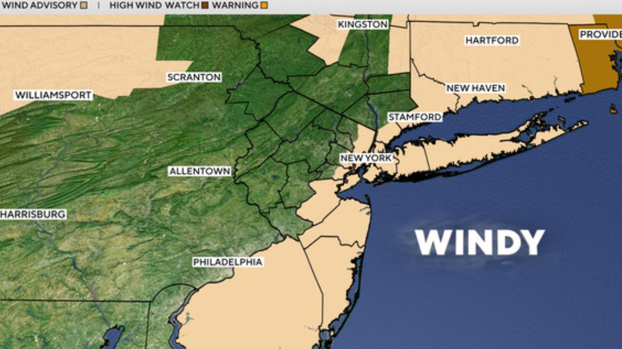
Wind Advisory Issued Across Tri-State Area
The National Weather Service has issued a Wind Advisory from 2 p.m. Monday until 4 a.m. Tuesday for several areas across the region.
Locations included in the advisory include:
- New York City
- Long Island
- Connecticut
- Eastern New Jersey
- Ulster County
- Dutchess County
- Westchester County
Forecasters say strong winds may develop throughout the afternoon and evening as the storm intensifies.
Wind gusts could approach or exceed 60 mph in some coastal locations, potentially causing minor damage and scattered power outages.
Flood Watch in Effect for Parts of Connecticut
In addition to strong winds, heavy rainfall is expected across the region.
A Flood Watch has been issued for Fairfield County, Connecticut, beginning Monday night and continuing through Tuesday morning.
Meteorologists say the storm could bring 1 to 2 inches of rainfall, with locally higher totals possible in some areas.
The heavy rainfall could lead to flash flooding in low-lying and flood-prone areas, especially where rainfall rates become intense.
Rain and Storms Could Impact Monday Commute
Weather conditions are expected to deteriorate quickly Monday morning as the storm system approaches.
Overnight temperatures will gradually climb into the 50s by early morning, creating conditions favorable for rain and thunderstorms.
During the morning commute, drivers may encounter periods of heavy rain and isolated thunderstorms.
Forecasters say these storms could create reduced visibility and slick road conditions for commuters.
Strong Storms Possible Monday Evening
After a temporary break in rainfall during the mid-morning hours, another round of storms is expected later in the day.
Meteorologists say a squall line of thunderstorms may move through the region between 8 p.m. and 11 p.m.
Some of these storms could become severe and produce damaging winds and intense downpours.
While the primary threat will be wind and heavy rain, forecasters say a small risk of tornadoes cannot be ruled out, especially in areas west of New York City.
Coastal Flooding Possible Along Long Island
Strong southerly winds associated with the storm could also push water toward the shoreline.
Meteorologists warn this may contribute to minor coastal flooding along the South Shore of Long Island as winds pile water onshore.
Residents in coastal communities are encouraged to monitor conditions closely during the evening hours.
Cold Air Returns After Storm Passes
Despite the stormy conditions, temperatures on Monday will remain relatively mild.
High temperatures are expected to reach the low to mid-60s across much of the region. However, conditions will change quickly after the cold front moves through Monday night.
Read Also: DEA Raid in West LA Leads to $300K Cash Seizure and Marijuana Sales Halted
As colder air arrives, rain could briefly transition to light snow before ending overnight.
Cooler Weather for St. Patrick’s Day
Following the storm, much colder air will settle into the region.
Tuesday is expected to be cold and breezy, with afternoon highs only reaching the low 40s.
The sudden temperature drop will create a sharp contrast from Monday’s warmer conditions.
Officials encourage residents to stay updated on weather alerts and allow extra travel time during periods of heavy rain and strong winds.
How is the weather looking in your area today? Share your thoughts respectfully in the comments and join the conversation.