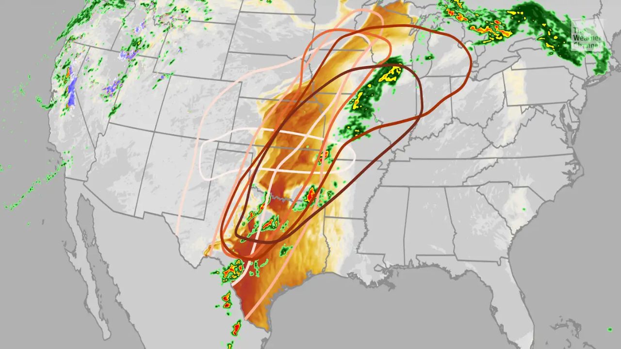
Kansas City, Missouri — Residents across the Kansas City metro area are being urged to stay weather-aware as forecasters warn of multiple Alert Days and an increasing threat of severe storms heading into the weekend and early next week.
Meteorologists say a combination of rising temperatures, strong winds, and increasing humidity will create favorable conditions for dangerous thunderstorms capable of producing damaging weather.
Warm and Humid Conditions Fuel Storm Threat
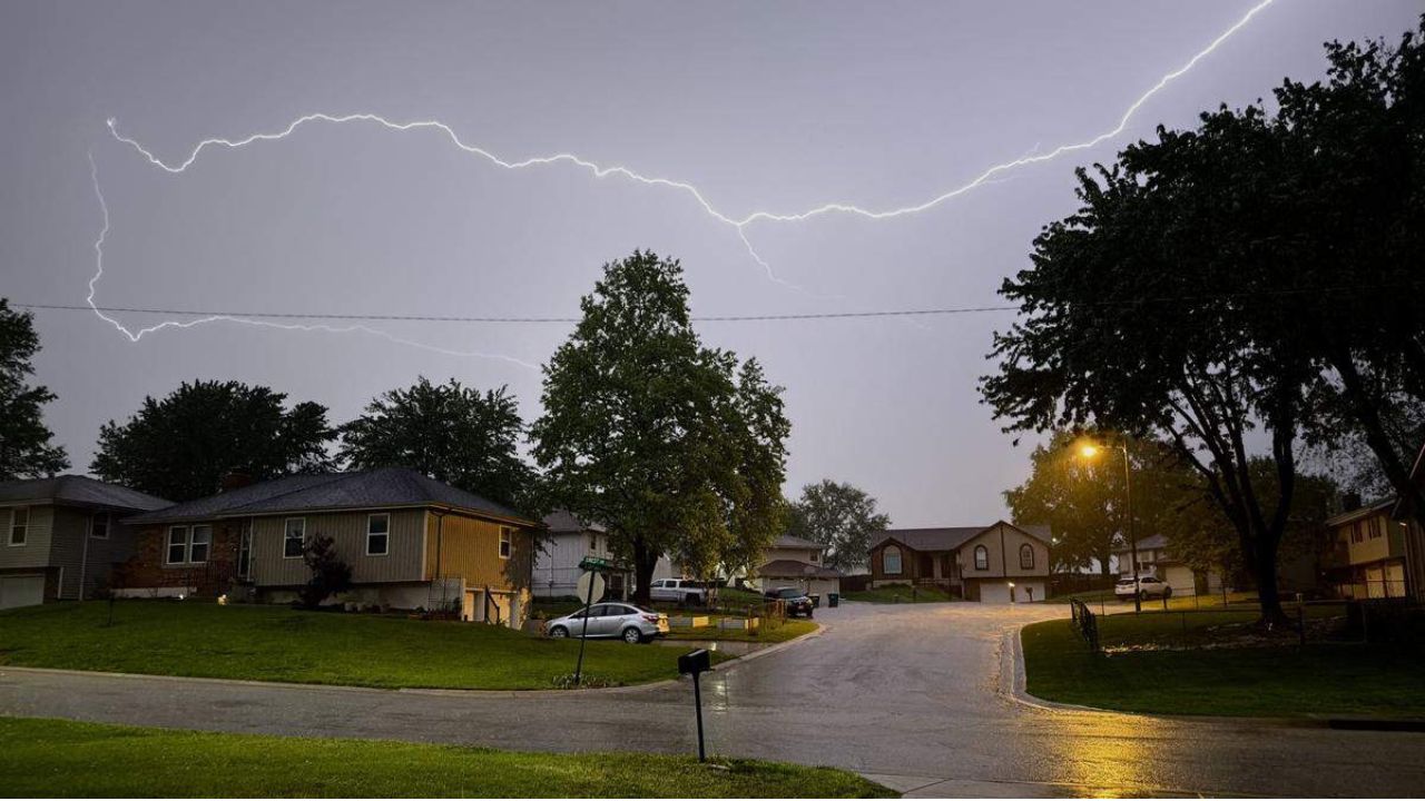
Thursday evening is expected to remain warm and breezy across the region, but weather experts say conditions will become more unstable as moisture continues building over the next several days.
By Friday, temperatures are forecast to climb into the upper 80s, creating an environment supportive of strong thunderstorm development.
Scattered showers and thunderstorms are expected to form later in the day and continue into the overnight hours.
Forecasters warn that any stronger storms could produce:
- Damaging wind gusts
- Large hail
- Heavy rainfall and lightning
Friday has officially been designated the first Alert Day for the Kansas City area due to the growing severe weather potential.
Another Round of Severe Storms Possible Saturday
The active weather pattern is expected to continue into Saturday, bringing another chance for scattered severe thunderstorms during the evening and overnight periods.
Saturday has also been declared an Alert Day, with meteorologists closely monitoring storm development across the region.
While outdoor activities and weekend plans could face interruptions from storms, forecasters emphasized that the entire weekend is not expected to be a complete washout.
Instead, storms are expected to occur in scattered waves, meaning some areas could experience severe weather while others remain dry.
Sunday Turns Hot, Windy and Humid
Conditions on Sunday are forecast to become even warmer and more humid across Kansas City.
Strong winds and muggy air will dominate much of the day, although current forecasts suggest the better storm chances may remain away from the metro area for most of Sunday.
Even so, forecasters caution that weather patterns could still shift, and residents should continue monitoring updates through the weekend.
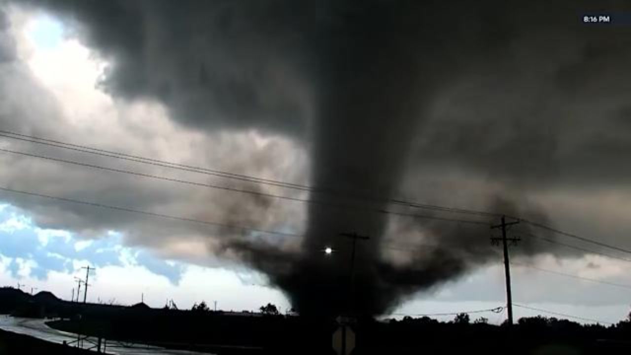
Monday Could Bring Strongest Severe Weather Threat
Another Alert Day has already been issued for Monday as a cold front moves through the region.
Weather experts say this system may bring the most widespread severe weather threat of the entire stretch.
Potential hazards expected Monday include:
- Damaging straight-line winds
- Large hail
- Possible tornadoes
Meteorologists say the cold front will provide additional energy and instability, increasing the likelihood of more organized and potentially dangerous storms.
Although it remains too early to pinpoint exact storm timing and intensity, forecasters are encouraging residents to prepare now and stay alert for watches and warnings early next week.
Residents Urged to Monitor Forecasts
With several rounds of storms possible over the coming days, emergency officials are advising residents to have multiple ways to receive weather alerts, especially overnight when severe weather can become more dangerous.
Drivers are also being reminded to use caution during heavy rain and avoid flooded roadways if storms produce localized flooding.
As severe weather season ramps up across the Midwest, the next few days could bring rapidly changing conditions to the Kansas City area.
Are you preparing for storms in your area this weekend? Share your weather updates and thoughts in the comments below.