Baltimore, Maryland — Maryland residents are being warned to prepare for a dramatic weather shift this week as near-record heat and unhealthy air quality give way to severe thunderstorms, heavy rain and much cooler temperatures heading into Memorial Day weekend.
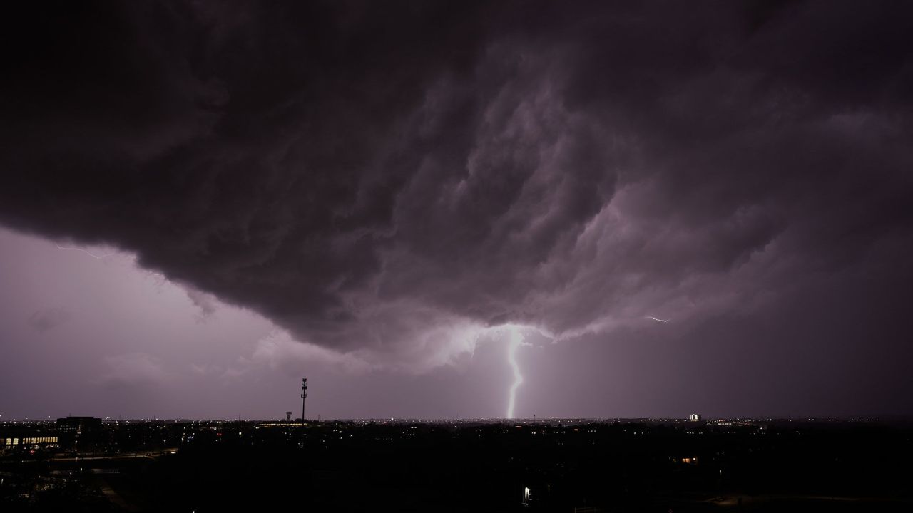
Forecasters say Wednesday could become one of the most active weather days the region has seen in weeks, with dangerous storms expected to impact parts of the state during the afternoon and evening hours.
Near-Record Heat Builds Across Maryland
Unusually hot temperatures continued across Maryland on Wednesday as parts of the state pushed toward the 95-degree mark, potentially tying a decades-old record set back in 1962.
The intense warmth has also contributed to worsening air quality conditions, particularly for individuals with respiratory or heart-related illnesses. Officials warned that sensitive groups should avoid prolonged outdoor activity during the hottest part of the day.
Meteorologists say the combination of high heat and humidity is creating unstable atmospheric conditions that could fuel strong storms later in the day.
Severe Storm Threat Targets Baltimore Area
The WJZ First Alert Weather Team declared Wednesday a First Alert Weather Day, warning residents about the potential for scattered strong to severe thunderstorms between 3 p.m. and 9 p.m.
Forecasters say any storm that develops could produce damaging wind gusts, intense lightning and blinding downpours, potentially creating hazardous travel conditions during the evening commute.
The storms may also bring sudden visibility issues and localized flooding in some areas. Residents are being urged to closely monitor weather updates and ensure they have multiple ways to receive emergency alerts.
While the highest threat is expected during the late afternoon and evening, meteorologists noted that isolated showers and storms could begin earlier in the day and continue overnight after weakening.
Air Quality Concerns Add to Weather Risks
Along with the heat and storms, Maryland residents are also dealing with poor air quality conditions. Experts warned that people with asthma, respiratory illnesses or cardiac conditions may experience additional breathing difficulties.
The unhealthy air quality is expected to gradually improve later in the evening as storms move through the region and cooler air begins to settle in.
Officials advised residents to stay hydrated, limit strenuous outdoor activities and remain indoors whenever possible during peak heat hours.
Cooler, Rainier Pattern Arrives Before Holiday Weekend
After Wednesday’s dangerous heat and storms, Maryland’s weather pattern is expected to shift dramatically into a much cooler and wetter setup.
Forecasters predict periods of rain Thursday and Friday, with temperatures dropping into the 50s as a strong east-to-northeast wind moves through the region.
Although it may not rain continuously, wet conditions are expected to linger for extended periods across much of the state.
Maryland Could See Record-Breaking Heat This Week Before Storms Crash the Memorial Day Weekend
The gloomy weather could affect outdoor plans leading into the holiday weekend, especially for residents hoping to spend time outside during Memorial Day events and gatherings.
Heavy Rain Could Bring Drought Relief
Despite the inconvenience, meteorologists say the incoming rainfall may provide a major benefit to the region.
Maryland has been dealing with ongoing drought concerns, and forecasters believe the state could receive between 1 and 3 inches of rain before the weather system finally moves out.
The rain is expected to become more scattered by Sunday into Memorial Day, allowing for occasional dry periods and slightly warmer temperatures returning to the upper 60s and lower 70s.
Officials continue to urge residents to stay weather-aware throughout the week as conditions rapidly change from extreme heat to potentially severe storms and prolonged rainfall.
How are you preparing for Maryland’s dramatic weather shift this week? Share your thoughts in the comments below.