Orlando, Florida — A developing storm system sweeping across the Southeast is expected to deliver much-needed rainfall to parts of Florida and neighboring states this weekend, offering temporary relief from elevated wildfire danger and persistent dry conditions.
Forecasters say while widespread soaking rain is not expected, many areas from Tennessee to the northern Gulf Coast and southern Atlantic Coast could receive between 0.50 and 1.50 inches of rain.
That rainfall may be enough to briefly reduce fire risk in some of the hardest-hit areas.
Fire Danger Elevated After Weeks of Dry, Windy Conditions
Recent weeks have brought a dangerous mix of dry brush, gusty winds and low humidity, fueling wildfire activity across portions of the Southeast.
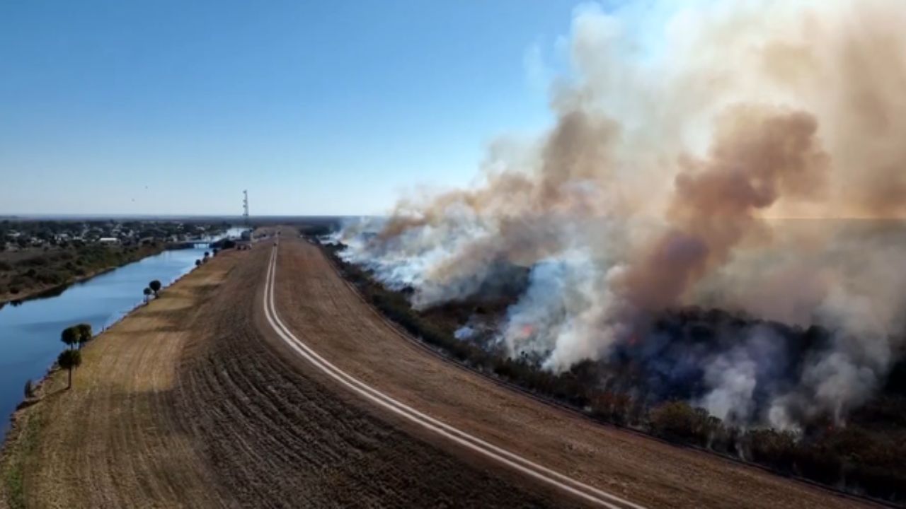
Some of the most significant fires have been burning in Florida. A wildfire in Big Cypress National Preserve, near Alligator Alley, had consumed 25,000 acres as of midweek.
According to the latest U.S. Drought Monitor, much of the Southeast is experiencing abnormally dry conditions or worse, with some pockets categorized in severe to exceptional drought.
“While most areas in the Southeast need several days of steady soaking rain — which is not likely — any rainfall will help knock down the wildfire threat in the short term,” a meteorologist said.
Rain Timing Across Florida
The moisture zone is forecast to shift southward over the Florida Peninsula beginning Friday night and continuing into Saturday.
From near Interstate 4 northward, showers and spotty thunderstorms are expected Friday evening into early Saturday.
Farther south — including areas from Melbourne to Miami — rainfall is more likely to come in the form of locally heavy, gusty thunderstorms on Saturday.
While totals may not be extreme, bursts of heavier rain could briefly improve soil moisture and reduce fire spread potential.
However, officials caution that this system is not expected to produce prolonged rainfall capable of fully reversing drought conditions.
Read Also: Warm Spell Holds Strong in Dallas Area Before Rainy Turn Next Week
Limited Rainfall Ahead Next Week
Looking ahead, a high-pressure system is forecast to build over the western Atlantic. That setup could pump warmer air into Florida and the Southeast while keeping the main storm track farther north — from the middle Mississippi Valley into the Great Lakes and Northeast.
This pattern may result in only limited rainfall opportunities next week across Florida and the Southeast.
If that occurs, fire risk could gradually increase again as vegetation dries out under warmer temperatures.
Travelers May Face Delays North
While Florida sees rain and thunderstorms, the same storm system could bring wintry weather to parts of the Midwest and Northeast, potentially leading to travel delays for those heading north.
Residents across Florida are encouraged to remain cautious with outdoor burning and monitor local fire advisories, even as rain moves through.
Are you seeing rainfall in your part of Florida this weekend? Let us know how conditions look in your area in the comments below.