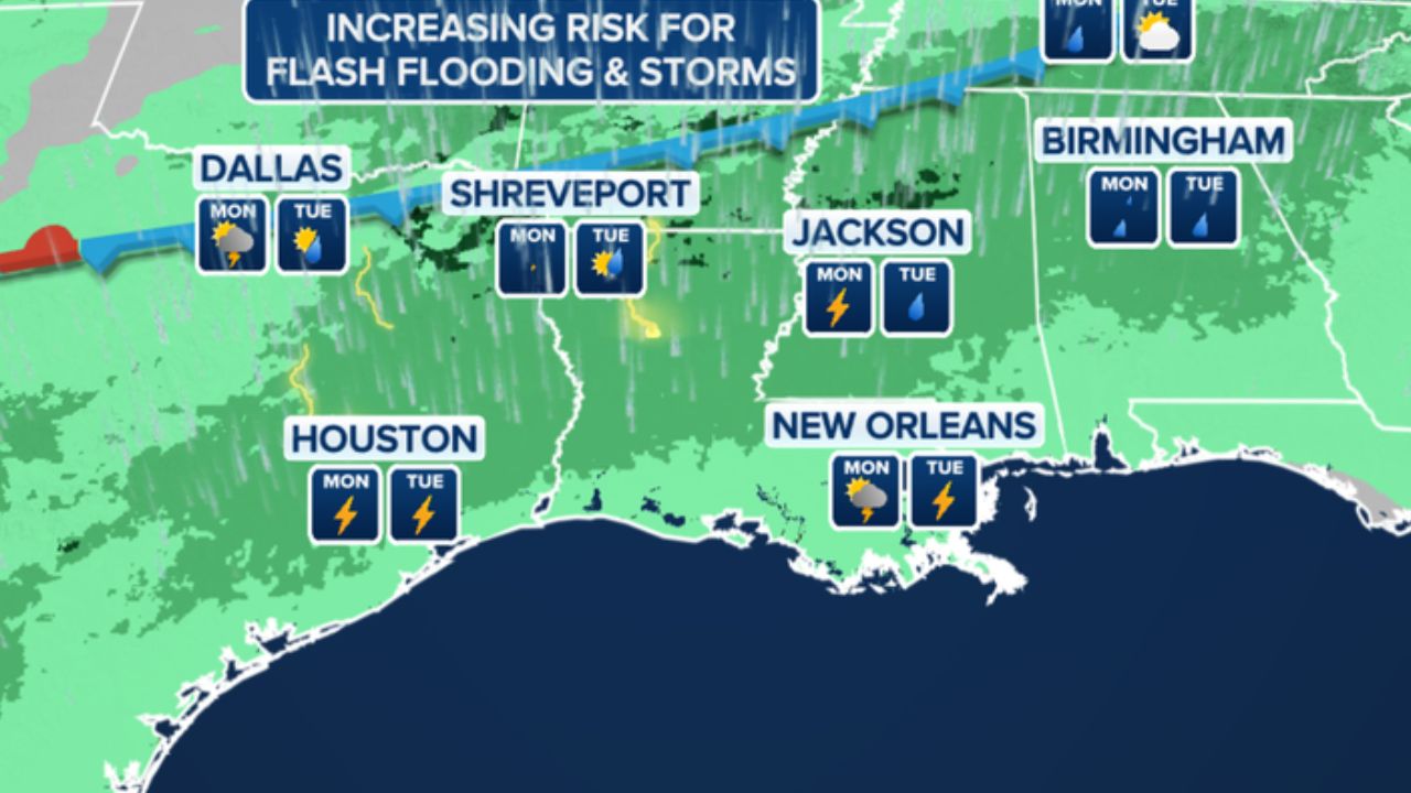
HOUSTON, TX – Southeast Texas is bracing for a significant shift in weather patterns early next week as tropical moisture is forecast to collide with a weak summer front, bringing an elevated risk of flash flooding.
Summer Heat and Humidity First
Through Saturday, Houston will remain in a typical summertime weather pattern. Afternoon high temperatures will sit in the low 90s, but intense humidity will make it feel closer to 100 degrees or higher.
The high heat index is a direct result of wet ground conditions and dense moisture across the region. Rain chances remain low at just 20% to 30% through Saturday afternoon.
The Pattern Change: High Rain Odds Ahead
The weather setup changes dramatically starting Sunday, June 14, as remnant tropical moisture surges into the area from the Gulf of Mexico.
- Sunday: Rain chances rise to 60%.
- Monday & Tuesday: Rain odds peak at 80%, triggering an official weather watch for the region.
Meteorologists warn that the incoming front could stall, creating a setup for “training storms”—where multiple intense downpours repeatedly move over the same local areas, leading to potential torrential rainfall.
Tropical Remnants to Blame
The surge in moisture is linked to the remnants of Tropical Storm Cristina from the Pacific. While the National Hurricane Center gives the system only a 10% chance of officially redeveloping in the Bay of Campeche, its deep tropical moisture field is moving directly toward the Texas coast.
Local residents are urged to keep a close eye on street flooding risks early next week, particularly during the Monday and Tuesday morning commutes.