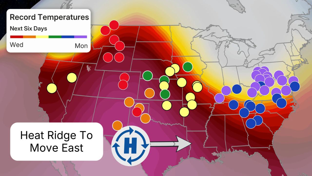
CHICAGO, IL — Millions of residents across the Central United States are on high alert today as meteorologists warn of a “significant severe weather outbreak.” After a week of destructive storms, the threat level has peaked, putting major cities like Chicago, Kansas City, and Madison directly in the crosshairs of potentially life-threatening weather conditions.
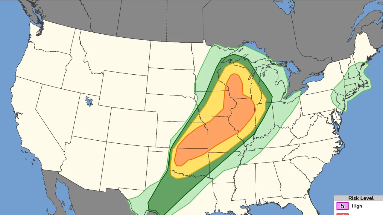
According to the Storm Prediction Center, more than 22 million people are currently at an enhanced risk for severe thunderstorms, destructive winds, and “strong to intense” tornadoes.
The “Most Dangerous” Day of the Week
While the Midwest has already been battered by storms earlier this week, experts warn that Friday, April 17, carries the most volatile setup yet. Adam Douty, a senior meteorologist at AccuWeather, stated that the current pattern has evolved into a multi-day outbreak.
“Friday’s setup has all the ingredients for significant severe weather,” Douty warned. “We are looking at a combination of destructive hail, damaging winds, and tornadoes that could stay on the ground for extended periods.”
High-Risk Zones: Where the Storms Will Hit Hardest
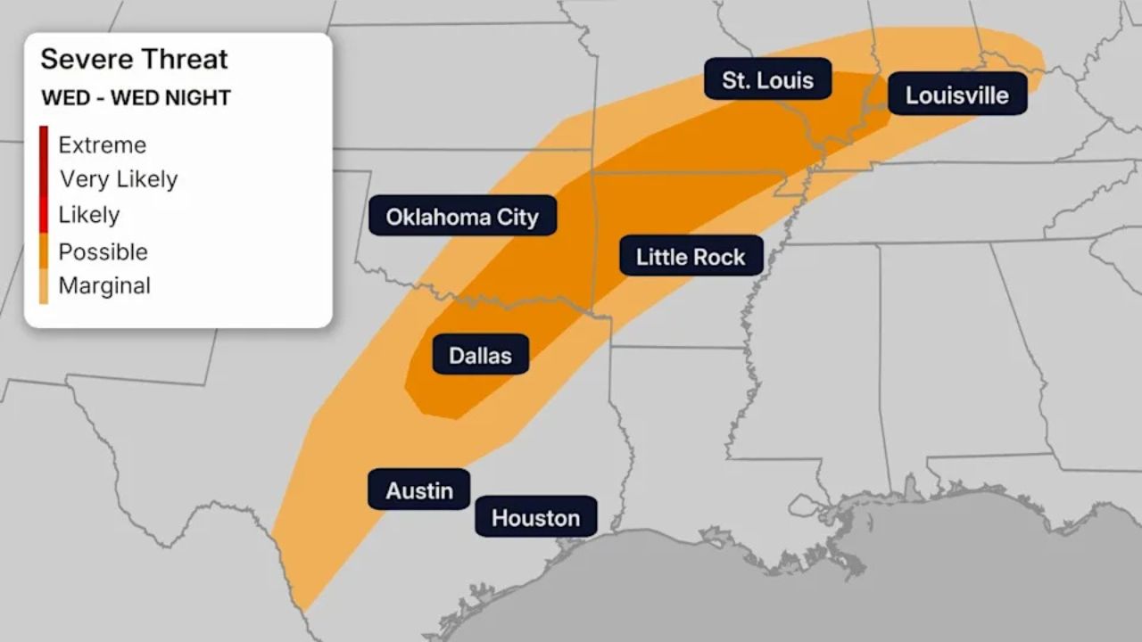
The threat stretches from Texas all the way up to the Midwest, but certain areas are facing a higher level of danger:
- Tornado Hotspots: Eastern Iowa, Wisconsin, and Northwest Illinois are under the highest risk for “strong to intense” tornadoes.
- Giant Hail & Wind: South-central Kansas and northwestern Missouri could see hail stones larger than 2 inches in diameter and wind gusts exceeding 75 mph.
- Flash Flooding: With heavy rainfall rates of 1 to 2 inches per hour, flash flooding is a major concern, especially in areas where the ground is already saturated from previous storms.
A Week of Destruction Continues
This latest wave follows a trail of devastation earlier in the week. Between April 14 and 15, at least eight tornadoes were confirmed in Michigan. In Juneau County, Wisconsin, a massive tornado—the state’s strongest since 2021—leveled a home and ripped the roof off a church in Waukesha County.
Authorities are concerned that the cumulative effect of these back-to-back storms has left many communities vulnerable and residents exhausted.
Safety First: How to Prepare
The National Weather Service and local authorities are urging residents to take immediate precautions. AccuWeather senior meteorologist Dan Pydynowski advises:
- Stay Charged: Ensure your mobile phones are fully charged and emergency alerts are enabled.
- Ready Your Shelter: Your safe place or storm shelter should be stocked with emergency supplies, including water, flashlights, and a first-aid kit.
- Avoid Flooded Roads: “Turn around, don’t drown.” Never attempt to drive through flooded areas, particularly at night when depth is hard to judge.
The Weekend Outlook
The threat won’t end on Friday. By Saturday, April 18, the storm system is expected to shift eastward, bringing the risk of tornadoes, wind, and hail to a region extending from Arkansas to southwestern New York, including much of Ohio. Forecasters expect the threat to finally diminish by Sunday, April 19.
Are you in the path of these storms? Share your local weather updates and photos in the comments below to help keep your neighbors informed. Stay safe, and stay tuned for more updates.