ORLANDO, FL – Dangerous wildfire conditions and record-breaking temperatures are gripping the Florida peninsula this Thursday, as a stalling cold front leaves the state vulnerable to extreme heat and dry air.
Wildfire Threat Across Central and Northeast Florida
A Fire Weather Warning has been officially issued for a large portion of the state, including Orlando, Daytona Beach, and Jacksonville. With 98.7% of Florida currently experiencing drought conditions, the risk of fire is at a critical level.
Forecasters warn that humidity levels have dropped to between 25% and 35%, while wind gusts are reaching up to 25 mph. Under these conditions, any small fire that ignites could spread rapidly and become uncontrollable.
Record Highs Forecasted
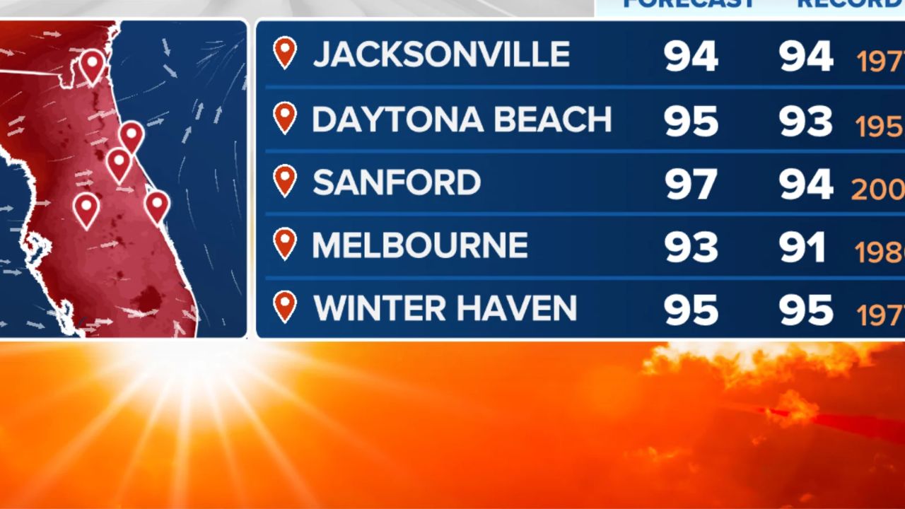
Temperatures on Thursday are running 5 to 10 degrees above the seasonal average. Residents can expect:
- Central Florida: Highs reaching the low to mid 90s.
- East Coast: Potential record-breaking heat in Daytona Beach, Jacksonville, and along the Space and Treasure Coasts.
While the heat is sizzling most of the state, Miami is expected to remain slightly cooler compared to the inland and northeastern regions.
Minimal Relief in Sight
According to the FOX Forecast Center, there is a chance of rain and thunderstorms returning by the weekend. However, experts caution that this relief will likely be short-lived. Expected rainfall totals remain low, meaning the widespread drought and fire risks are expected to persist well into next week.
Safety Precautions
Local fire officials are urging residents to avoid any outdoor burning and to dispose of cigarettes properly. Motorists should also avoid parking vehicles on dry grass, as heat from the exhaust can easily spark a blaze.