MICHIGAN — Residents across the southern half of the Lower Peninsula are being urged to stay weather-aware this weekend as a multi-wave storm system threatens to bring damaging winds, large hail, and localized flooding to the region.
From the lakeshores of West Michigan to the tip of the Thumb, meteorologists are tracking a shifting weather pattern that has already prompted upgraded risk levels for several major metros, including Detroit and Grand Rapids.
Timeline: When the Storms Hit
The weather event is expected to unfold in two distinct waves:
- Wave 1 (Friday Night – Saturday Morning): Initial rain and storms will begin overnight Friday. The National Weather Service (NWS) identifies the “best window” for stronger activity between 11 p.m. Friday and 6 a.m. Saturday.
- Wave 2 (Saturday Afternoon – Evening): A second, potentially more intense round is expected between 2 p.m. and 8 p.m. Saturday, specifically targeting Southeast Michigan.
Regional Breakdowns: Hail and Wind Risks
While the entire lower half of the state is under watch, the specific hazards vary by region.
West Michigan & Central Michigan
The NWS team in Grand Rapids warns that overnight storms could pack quarter-sized hail. The primary risk zone for hail stretches in a line south of Holland over to Jackson, encompassing Grand Rapids and Kalamazoo.
Southeast Michigan (Metro Detroit & The Thumb)
Forecasters have upgraded the risk level for the “corner” of the state. Areas from Monroe and Detroit up to Port Huron have moved from a “marginal” risk to a “slight” risk (Level 2 of 5).
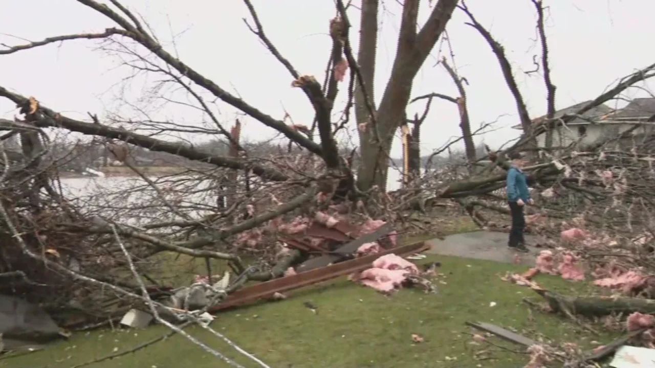
“Wind gusts of 60 mph is the primary hazard, with localized hail of 1 inch or greater and isolated tornado also possible,” the NWS Detroit office stated.
Flooding Concerns: Up to 3 Inches of Rain
In addition to the wind and hail, water levels are a significant concern. A line of counties along the southernmost border of Michigan has been placed in an excessive rain zone.
- Rainfall Totals: Widespread rain could drop up to 3 inches in parts of West Michigan.
- Urban Impact: Experts warn that as little as 1.5 inches is enough to trigger flooding in urban areas, low-lying spots, or neighborhoods with poor drainage.
Safety Reminders
Local officials advise residents to secure outdoor furniture, clear storm drains if possible, and ensure weather alerts are enabled on mobile devices. If you encounter flooded roadways this weekend, remember: Turn around, don’t drown.