SCRANTON/STATE COLLEGE, PA — Residents across Northeast and Central Pennsylvania should soak up the sun while it lasts. After a beautiful Thursday, a shifting weather boundary is set to bring clouds and damp conditions just in time for the weekend.
Thursday: The “Pick of the Week”
Today is shaping up to be a standout day across the region. High-pressure systems are delivering plenty of sunshine, making it the perfect afternoon for outdoor activities.
- Conditions: Clear and sunny.
- Highs: Reaching the lower 70s this afternoon.
- Tonight: Temperatures will dip into a crisp mid-40s under partly cloudy skies.
Friday: The Boundary Shift
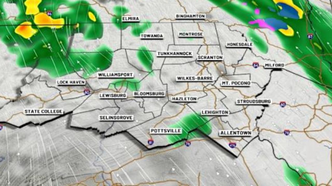
The weather begins to turn on Friday as a frontal boundary settles across the state. The main “if” for Friday depends on exactly where this boundary lands.
- Sky Cover: Partly to mostly cloudy.
- Precipitation: A stray shower or two is possible, though a shift in the boundary’s position could lead to more widespread rain.
- Temperatures: Slightly cooler with highs in the mid-60s.
Weekend Outlook: Chilly and Damp
Prepare to grab the rain gear and a light jacket, as Saturday looks to be the least pleasant day of the week.
Saturday: A chilly, damp start to the weekend. Expect persistent clouds and rain showers.
- Highs: Struggling to reach the lower 50s.
- Higher Elevations: Some areas may stay trapped in the 40s all day.
Sunday: Conditions improve slightly. While a shower remains possible, the majority of the day is expected to be dry but overcast.
- Highs: Recovering to near 60.
The Week Ahead: Brief Recovery Before More Rain
The roller coaster of temperatures and moisture continues into early next week.
- Monday: A return to pleasant weather with a mix of sun and clouds. Highs in the mid-60s.
- Tuesday: Rain showers return to the region.
- Wednesday: Expected to dry out once again.
What are your weekend plans, Pennsylvania? Are the Saturday rain showers washing out your outdoor events, or are you heading to the higher elevations? Let us know in the comments below!