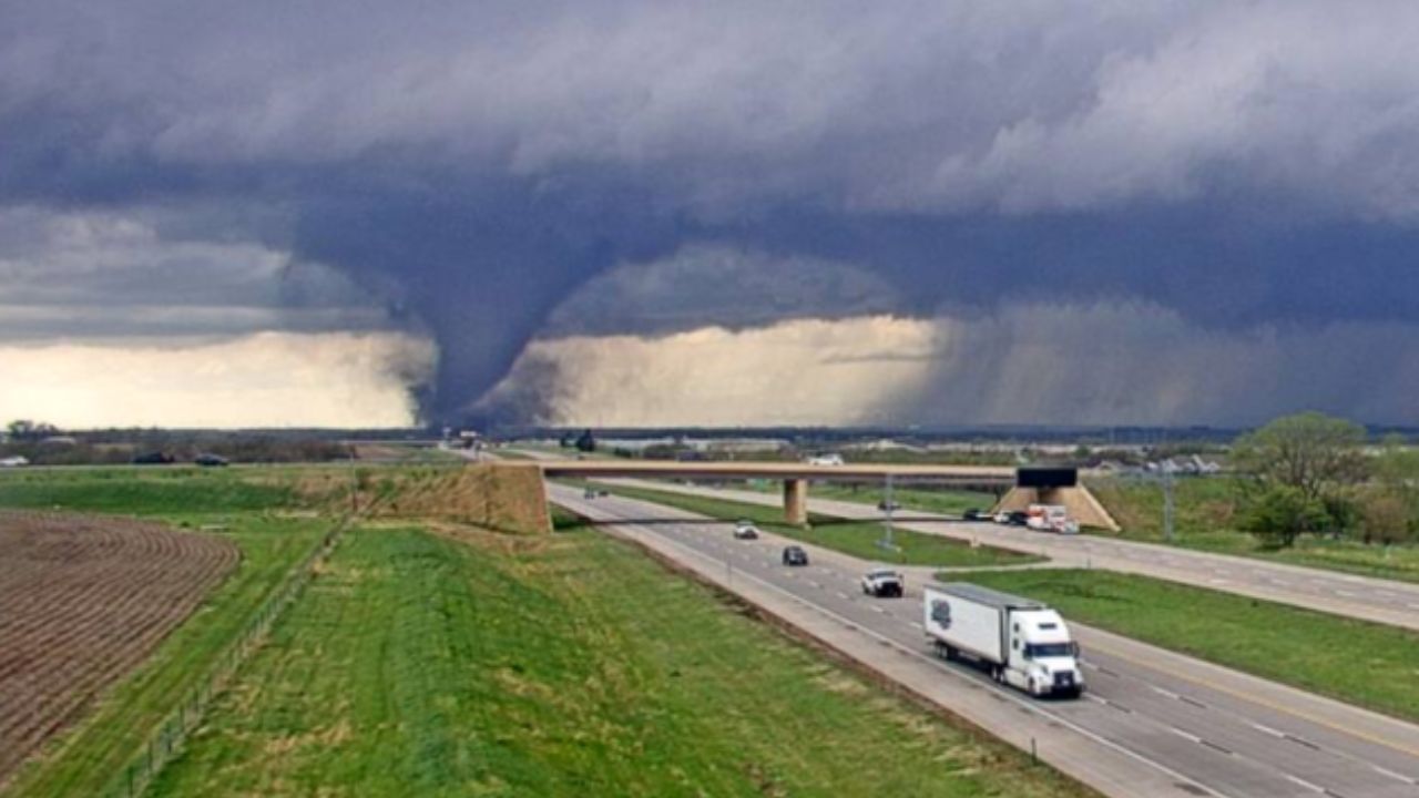
CENTRAL U.S. — Residents across the Great Plains and Midwest are being urged to prepare for a prolonged stretch of severe weather as a new atmospheric pattern takes shape this weekend. After a brief midweek reprieve for many, meteorologists warn that a potent storm system moving from the West will trigger daily rounds of intense thunderstorms, bringing threats of tornadoes, damaging winds, and large hail through early next week.
The Calm Before the Storm
For much of this week, a vast area of dry air is expected to keep the eastern two-thirds of the country relatively quiet. While the Florida Peninsula and isolated pockets of the Southwest may see heavy rain, most of the Heartland will remain dry until Friday.
However, the setup changes rapidly as a storm system moving onshore in California begins its trek inland. This system will act as a vacuum, drawing deep moisture from the Gulf of Mexico northward into the Plains, setting the stage for an explosive weather weekend.
Weekend Forecast: Storms Ignite
The severe threat is expected to begin in earnest on Saturday, with experts focusing on a corridor stretching from southwestern Nebraska to eastern New Mexico, including central and northwestern Texas.
By Sunday, the risk zone will broaden and march eastward. Residents from central Texas to eastern Nebraska and much of Iowa should stay weather-aware, as the atmosphere becomes increasingly primed for rotating storms.
Monday and Beyond: Potential Outbreak
As we head into Monday, the risk shifts further into the Midwest. The projected danger zone currently includes:
- Northeastern Texas
- Southeastern Minnesota
- Southern Wisconsin
- Northeastern Illinois
Meteorologists caution that both the coverage and intensity of these storms may increase each day. If hundreds of individual storm reports occur daily, the event could evolve into a significant regional outbreak.
Flooding Concerns Following March Rains
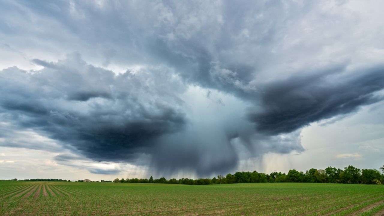
Beyond the wind and hail, “drenching downpours” pose a secondary threat. Because many areas from Missouri to Michigan are still recovering from heavy rainfall in late March and early April, the ground is already saturated.
“While parts of the region need rain, too much may fall too quickly for the ground to absorb,” forecasters warned, noting that streams and rivers currently at high levels may rise again or reach new crests.
Stay Prepared
The exact timing and “eastward shift” of the severe threat will depend on the speed of the incoming Western storm. Local residents are encouraged to:
- Check Local Forecasts: Updates will become clearer as the weekend approaches.
- Have a Plan: Identify your safe room or storm shelter now.
- Enable Alerts: Ensure your smartphone is set to receive emergency weather notifications.
Are you in the path of this weekend’s storms? Share your local conditions and photos with us in the comments below, but only if it is safe to do so.