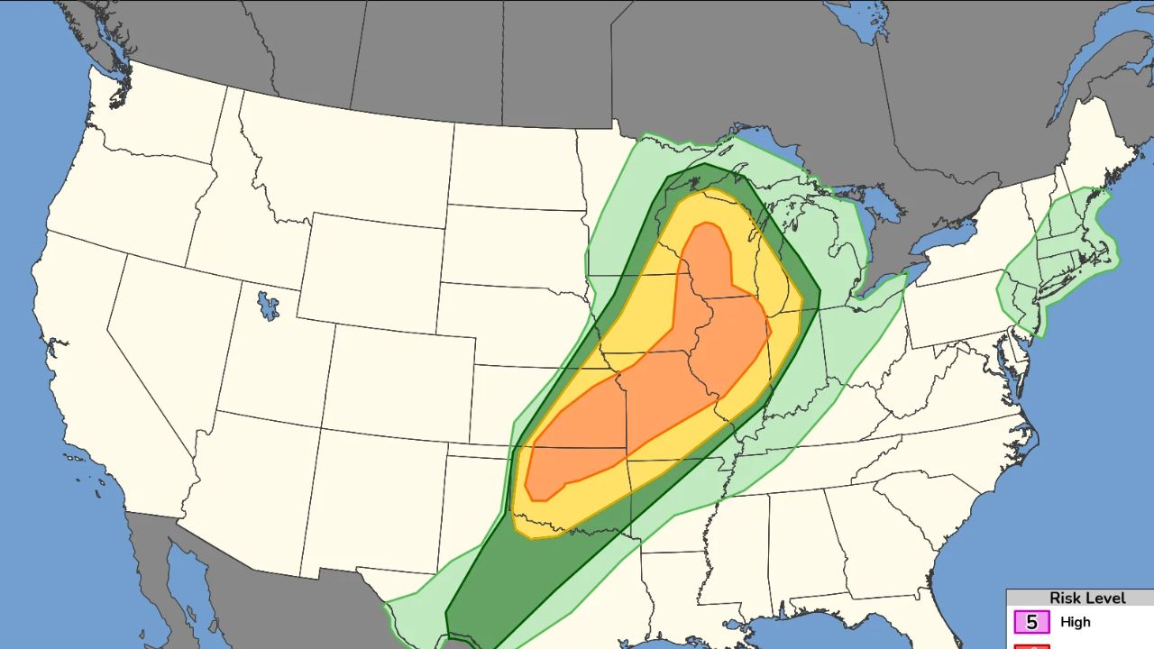
CHICAGO, IL – A shift in Wednesday’s weather system spared the immediate Chicago area from forecasted high-end tornadoes, redirecting the severe threat further south into central Illinois where multiple twisters touched down.
Tornado Touchdowns in Central Illinois
Morning showers and thunderstorms effectively pushed a warm weather front south of the Kankakee River Valley, altering the Storm Prediction Center’s “moderate” threat level.
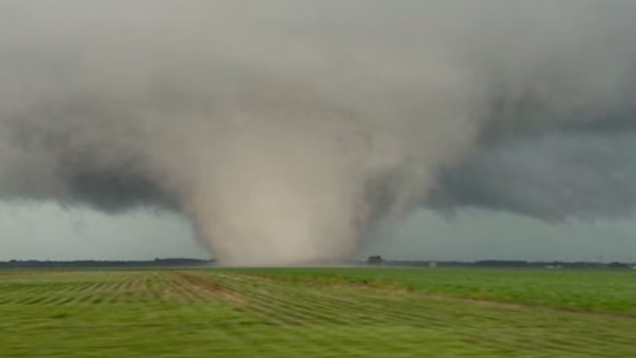
While Chicago avoided the worst, central Illinois faced multiple tornado touchdowns. Significant activity was reported in the following areas:
- Effingham: Multiple twisters were confirmed near the area.
- Charleston: A tornado struck the home community of Eastern Illinois University.
- Mattoon: Video footage captured a tornado striking near the town during the peak of the outbreak.
Authorities confirmed there were no immediate reports of injuries from the central Illinois touchdowns.
Chicago Impact: High Winds and Flash Flooding
Though Chicago escaped the tornado threat, the morning storm system still caused widespread disruption across the metro area. High winds downed utility poles across the city, and severe weather concerns triggered brief ground stops at both O’Hare and Midway airports.
“Torrential” downpours also prompted Chicago officials to issue an Overflow Action Alert. Residents were advised to reduce water usage—including delaying showers and laundry—to prevent major flash flooding and protect local water quality.
Weather Threat Diminishes
A brief tornado warning was issued for Lake County on Wednesday night after Doppler radar indicated rotation, but the warning was canceled after just 15 minutes.
By 10:00 p.m., the National Weather Service (NWS) confirmed that the severe weather threat had officially diminished, leaving only scattered showers for the remainder of the night.