Kansas City, Missouri — Fire officials are urging extreme caution Friday as strong winds and critically low humidity create dangerous wildfire conditions across northern and central Missouri and parts of eastern Kansas.
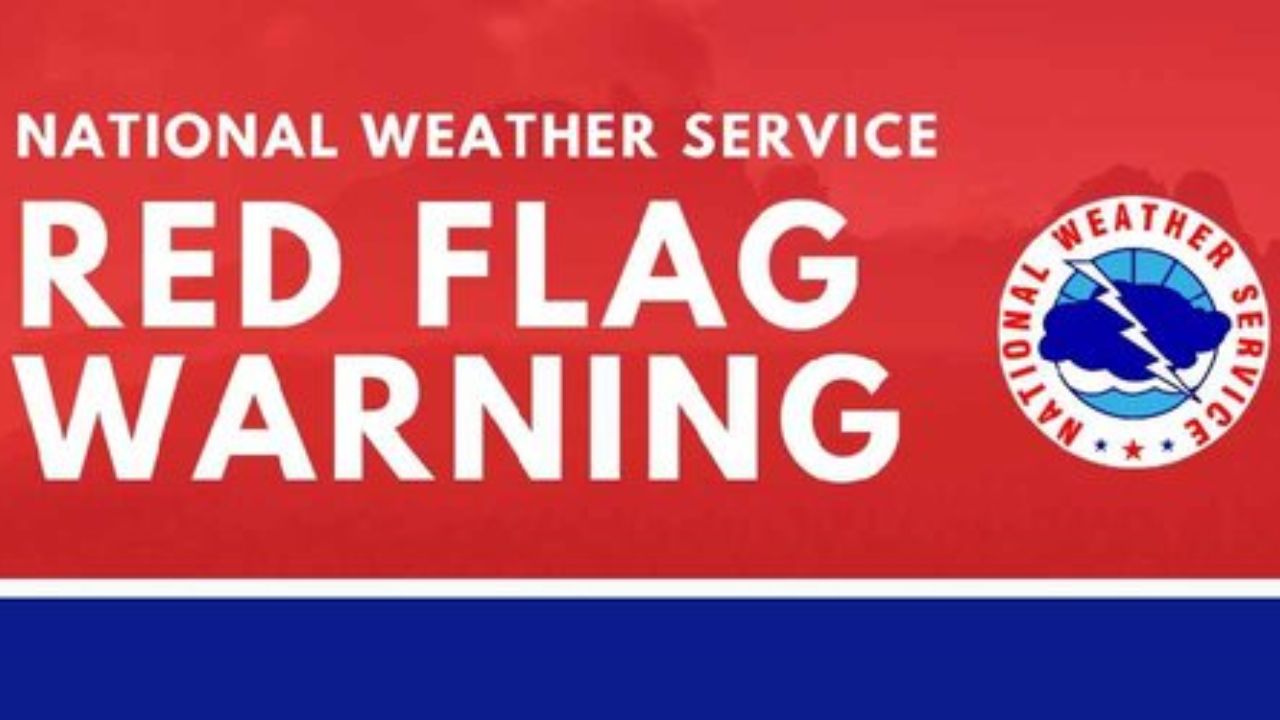
The National Weather Service in Kansas City/Pleasant Hill has issued a Red Flag Warning in effect from noon until 6 p.m. Friday for dozens of counties in the region.
Critical Fire Conditions Developing
Forecasters say southwest to west winds will increase to 15 to 20 mph, with gusts reaching 25 to 30 mph throughout the afternoon.
At the same time, relative humidity levels are expected to drop below 25 percent, creating an environment where any spark could quickly turn into a fast-moving grass fire.
Officials warn that conditions will support rapid fire growth and spread, especially in open areas with dry vegetation.
Counties Under the Warning
In Missouri, the Red Flag Warning extends from the Iowa border southward through:
- Buchanan County
- Clay County
- Platte County
- Jackson County
- Carroll County
- Randolph County
- Macon County
- Linn County
In eastern Kansas, counties under the alert include:
- Miami County
- Linn County
- Johnson County
- Atchison County
- Doniphan County
- Leavenworth County
- Wyandotte County
Kansas City metro communities are among those facing an elevated fire risk.
What Residents Should Avoid
With dry grass and gusty winds, even everyday activities could ignite a fire.
Officials strongly discourage:
- Outdoor burning
- Discarding cigarettes improperly
- Using power equipment that produces sparks
- Dragging unsecured trailer chains
Read Also: Another Winter Storm May Target NYC, New Jersey and Connecticut Next Week
Drivers are also advised to avoid parking vehicles on dry grass, as hot exhaust systems can ignite vegetation.
Any fire that starts before winds ease could spread rapidly and become difficult to control.
When Conditions Improve
The most dangerous window for fire growth is expected between noon and 6 p.m. Friday. Conditions should gradually improve after sunset as winds weaken and humidity begins to recover.
However, emergency officials stress that heightened awareness is critical throughout the afternoon. Residents are encouraged to report smoke or fire immediately and to remain vigilant in dry, open areas.
Are you seeing gusty winds or dry conditions in your area today? Share what conditions look like in your community in the comments below.