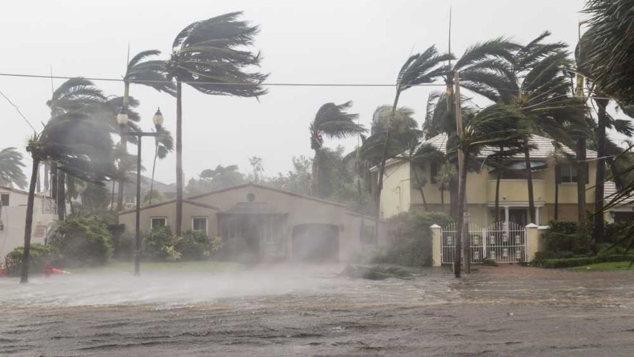
A dangerous and prolonged stretch of severe weather is set to batter the Plains and Upper Midwest from this weekend through next week — bringing heavy rainfall, giant hail, destructive wind gusts, and an escalating tornado threat across millions of Americans.
⚠️ Weather Alert: Tuesday is forecast to be the most dangerous day of the entire event. If you live in an at-risk zone, have a severe weather plan ready now.
Far-Reaching Flood Risk — Texas to Michigan
The most consistent and widespread threat will be heavy downpours capable of disrupting outdoor plans and slowing travel from Texas to Michigan. Between Friday and Wednesday, a general 1–4 inches of rain is expected across the region, with localized totals reaching 6–8 inches in some areas.
While the rainfall may help ease long-term drought across parts of the Plains and Mississippi Valley, it could worsen ongoing flooding across the Upper Midwest — particularly when combined with already elevated stream levels and melting snowpack across the northern tier. Flash flooding may also strike urban areas and small streams farther south.
On some days, severe thunderstorms will span up to 1,500 miles. The storms are likely to be scattered through the weekend but could become much more widespread during the upcoming week.
Day-by-Day Breakdown
🟡 Friday Night — Limited Coverage
The severe weather zone will be relatively limited on Friday night, centered over the southern Plains. The greatest threats — stretching from northeastern New Mexico to southwestern Missouri — will be large hail and strong wind gusts.
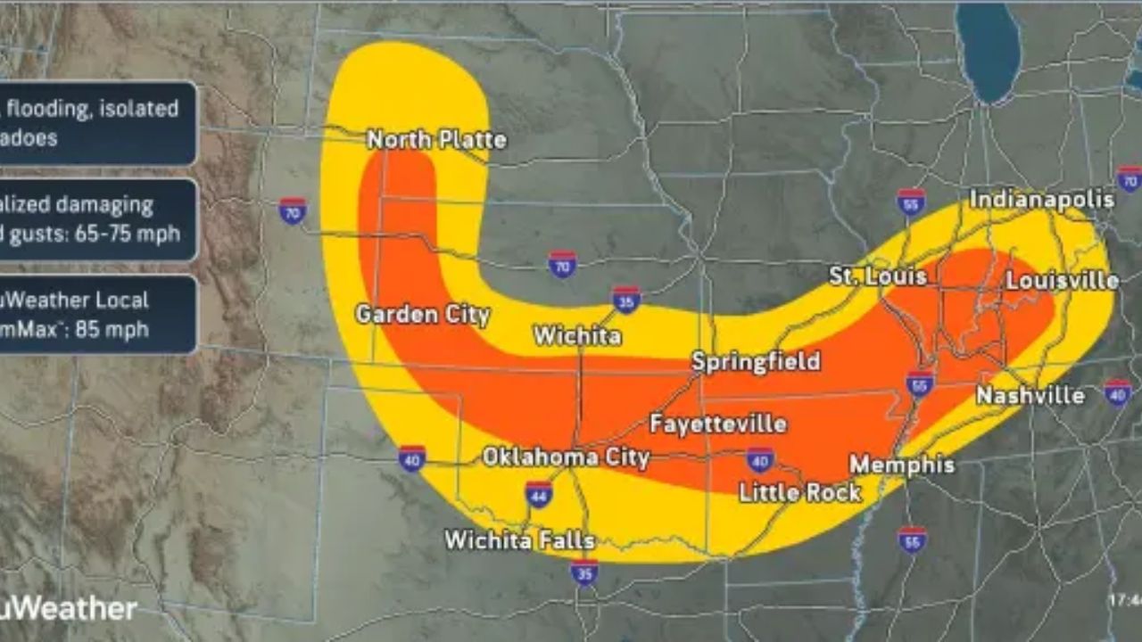
🟠 Saturday — Baseball-Sized Hail & 85 mph Gusts
Widely separated severe thunderstorms may produce large hail and wind gusts of 60–70 mph, with an AccuWeather Local StormMax™ of 85 mph. Ranchers should move livestock to shelter, as baseball-sized hail is possible. Vehicles could also be dented and damaged where the biggest hail falls.
🔴 Sunday — Tornadoes Possible Across 10 States
Severe storms will expand to cover areas of 10 states, stretching from near the Rio Grande in central Texas all the way to near Duluth, Minnesota. Storms on Sunday could bring a few tornadoes, along with high winds and large hail. Major cities at risk include Dallas, Oklahoma City, Minneapolis, and Kansas City, Missouri.
🔴 Monday — Chicago & St. Louis in the Crosshairs
Storms will develop along a zone similar to Sunday — from central Texas to east-central Minnesota and central Wisconsin. High winds, hail, and a few tornadoes will extend eastward, reaching the Chicago and St. Louis metro areas by Monday.
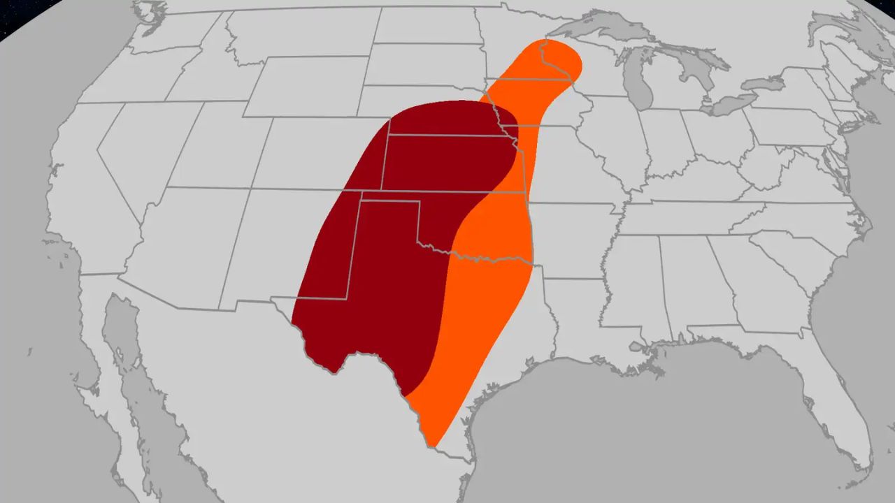
🚨 Tuesday — The Most Dangerous Day
Tuesday could be the most significant severe weather day across the Central states. A concentrated zone of dangerous storms is forecast from central Oklahoma to southeastern Iowa and northwestern Illinois, endangering lives and property across a wide swath of the country. The threat of hail, high winds, and tornadoes will extend from central Texas to central Wisconsin and across much of Michigan’s Lower Peninsula.
🟠 Wednesday — Risk Shifts Eastward
The severe thunderstorm threat will shift eastward on Wednesday and may not be as extreme as Tuesday, but storms could still disrupt travel and cause property damage. Thunderstorms are expected from northeastern Texas to southeastern Minnesota, central Wisconsin, southern Michigan, and southwestern Ontario.
What You Should Do Now
- Stay off flooded roads — turn around, don’t drown
- Avoid waterfall viewing and outdoor recreation in the Upper Midwest due to dangerous flood conditions
- Have a tornado safety plan ready — especially ahead of Tuesday
- Ranchers and farmers should secure livestock and equipment before the weekend
- Keep your phone charged and weather alerts turned on throughout the week
This weather event is expected to continue through at least mid-next week. Monitor your local National Weather Service forecasts for the latest updates specific to your area.