San Antonio, Texas – San Antonio is getting a taste of spring as temperatures climb well above normal heading into Friday, peaking near 82°F. However, the warm stretch won’t last uninterrupted, as increasing moisture brings a strong chance of rain and possible thunderstorms during Valentine’s weekend before dry, warm conditions return next week.
Incident Overview
The city begins the day under a low, gray cloud deck with morning temperatures near 66°F. Patchy fog lingers after sunrise, particularly south and east of downtown, where visibility may briefly drop along major routes like I-35 and Loop 410. While the early hours feel gloomy, the atmosphere is setting the stage for an unusually warm late-winter pattern across South Texas.
Timeline of Weather Changes
As the morning fog gradually lifts, cloud cover thins and sunshine breaks through by late morning. Afternoon highs rise to around 76°F, several degrees above the seasonal February average. The mild conditions continue overnight, with lows near 56°F and partly cloudy skies.
By Thursday, the warming trend strengthens. Partly sunny skies allow temperatures to climb to about 79°F, accompanied by a light southeast breeze. This wind shift is a key signal that warmer and more humid air from the Gulf is moving inland.
Friday’s Springlike Warmth
Friday stands out as the warmest day of the stretch. Afternoon highs reach approximately 82°F, giving the city a distinctly springlike feel more typical of early April than mid-winter. Outdoor plans, including early Valentine’s celebrations, should benefit from dry conditions during the day.
However, the pleasant weather begins to change by Friday night. Moisture levels increase rapidly, and shower chances rise to around 50 percent after midnight. Clouds thicken, and southeast winds gust up to 20 mph, signaling the approach of a more unsettled pattern.
Weekend Rain and Storm Chances
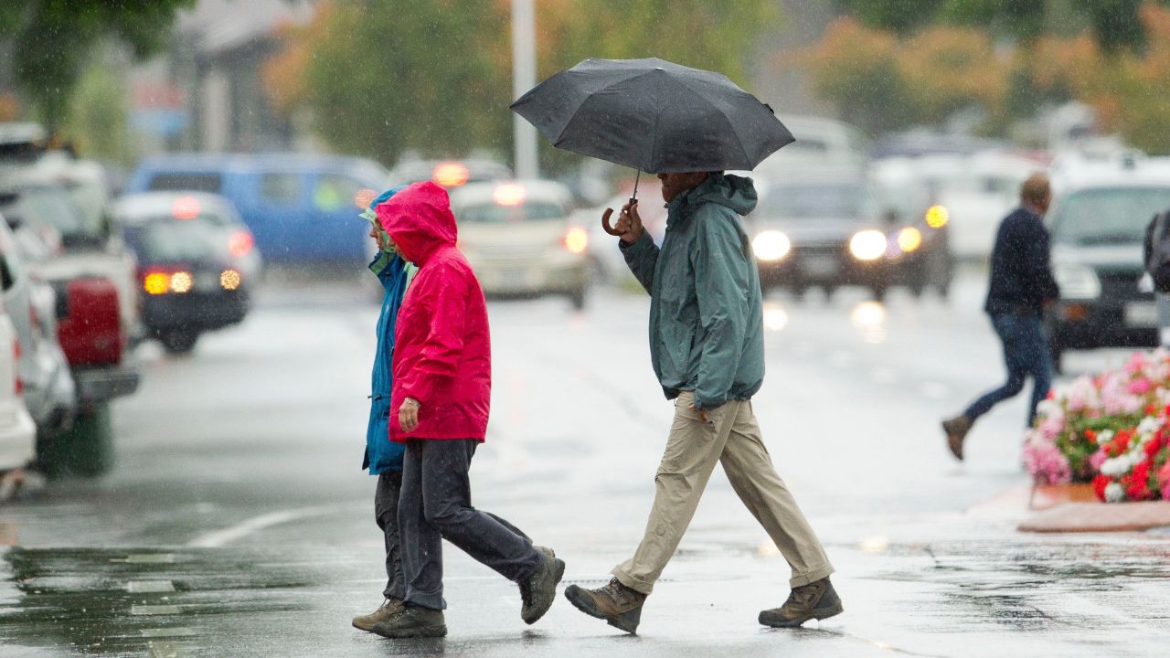
The highest impact weather arrives on Saturday. Showers become likely during the morning hours, with rain chances climbing to 80 percent by midday. A thunderstorm is also possible, especially during periods of heavier rainfall. Drivers should be prepared for slick roads and reduced visibility, particularly during peak travel times for weekend plans and Valentine’s events.
“Rain could develop quickly Saturday morning, and heavier downpours may cause brief travel delays,” forecasters note, emphasizing caution for early commuters and event-goers.
Rain gradually tapers off Saturday night, though a slight chance of lingering showers may persist before midnight.
Sunday Improvement and Dry Conditions
By Sunday, conditions improve noticeably. Skies turn mostly sunny, and temperatures rebound to around 77°F, providing a calmer and drier end to the weekend. Humidity levels drop slightly, making outdoor activities more comfortable.
Extended Outlook and Regional Context
Looking ahead, the warming trend continues into early next week. Washington’s Birthday is expected to reach near 79°F, with Tuesday climbing back into the lower 80s. Longer-range forecasts favor above-normal temperatures across much of Texas and the central United States, reinforcing what many meteorologists are calling a February thaw.
This pattern reflects a broader regional shift, where winter cold fronts remain farther north while warm Gulf air dominates the southern Plains. While the warmth is welcome, it also increases the likelihood of periodic rain events as moisture interacts with passing weather systems.
Safety and Travel Awareness
With fog, rain, and gusty winds all expected at different points, residents should stay weather-aware:
- Allow extra travel time during foggy mornings and rainy Saturday conditions
- Watch for slick roads during heavier downpours
- Secure lightweight outdoor decorations ahead of gusty southeast winds
Conclusion
San Antonio’s forecast offers a clear contrast: near-spring warmth by Friday followed by a wet Valentine’s weekend, then a return to sunshine and continued warmth next week. While temperatures remain comfortably high, residents should plan around Saturday’s rain to avoid disruptions.
Call to Action
Weather patterns like this can affect travel, events, and daily routines. Share your experiences in the comments below.