
Little Rock, Arkansas — Repeated rounds of heavy rain could push rivers toward flood stage across southern Arkansas and northern Louisiana beginning March 7, raising concerns for low-lying communities ahead of St. Patrick’s Day.
According to the NOAA Climate Prediction Center outlook issued February 27 and valid March 7–13, a broad zone shows a 60–70% probability of above-normal precipitation across the South-Central United States.
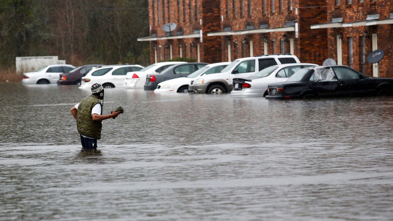
More concerning, a greater than 60% high-risk area for heavy precipitation from March 7–10 is centered over the Lower Mississippi Valley, placing the Arkansas–Louisiana corridor squarely in a prime flood zone.
Rainfall Totals Could Top 4 Inches
Forecast models indicate weekly rainfall totals may exceed 3 inches, with localized pockets approaching 4 inches. In the highest-risk zone, three-day rainfall amounts could surpass 2 inches, increasing the potential for:
- Flash flooding in urban and rural areas
- Rapid creek and stream rises
- Elevated river levels along major waterways
- Water-covered roads during heavy downpours
Repeated rain bands over already saturated soils could significantly enhance runoff, particularly in Delta regions.
Arkansas Cities on Alert
In Arkansas, communities including Little Rock and Pine Bluff could see rising water levels along the Arkansas and Ouachita rivers.
Low-lying neighborhoods and agricultural areas may experience ponding or minor flooding if heavier rainfall materializes. Major travel corridors such as I-30 and U.S. 165 could see temporary water coverage during intense storms.
Louisiana River Parishes Watching Closely
Across northern Louisiana, Shreveport and Monroe, along with parishes near the Red and Ouachita rivers, may face increasing flood concerns if repeated rainfall persists.
Highways such as I-20 could be impacted by heavy downpours, especially in areas prone to poor drainage.
Warmer Temperatures Could Sustain Pattern
The 8–14 day temperature outlook for March 7–13 shows a 70–80% probability of above-normal temperatures across much of the region.
Warmer air can:
- Maintain an active storm track
- Increase moisture availability
- Prolong periods of unsettled weather
This combination may help sustain repeated rainfall episodes through mid-March.
Read Also: California Snowpack Rises After February Storms — But Still Falls Short of Average
Flood Risk Could Persist Through March 13
Flooding concerns may remain elevated through at least March 13, especially if rainfall trends toward higher-end projections. Officials say river advisories and flood warnings are likely if totals exceed expectations.
Residents in flood-prone areas are urged to:
- Monitor local forecasts and river gauge updates
- Avoid driving through water-covered roadways
- Secure outdoor belongings ahead of heavier rain
With multiple rounds of rain forecast, the Arkansas–Louisiana corridor faces a heightened flood threat as March begins.
Are you located near the Arkansas, Red or Ouachita rivers? Share how you’re preparing for potential flooding — respectfully — in the comments below.


