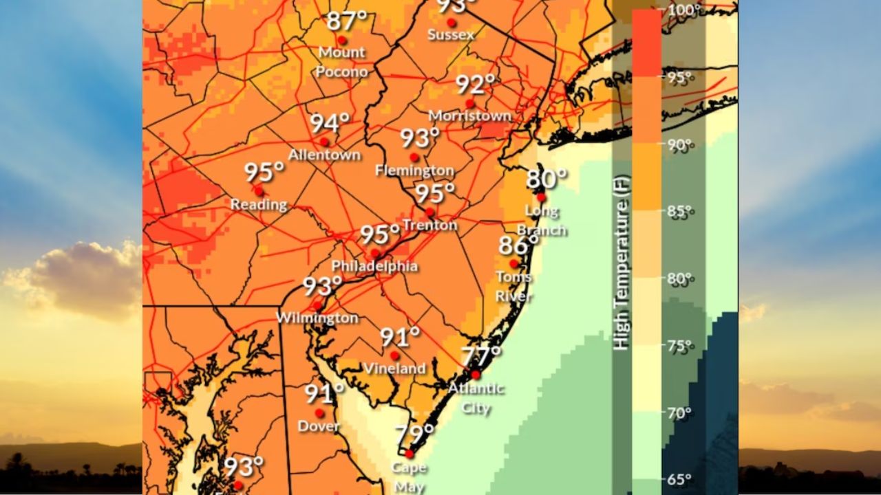
NEW YORK, NY – A powerful surge of summer air has triggered a Heat Advisory for portions of the tri-state area, bringing the hottest temperatures of the year so far on Tuesday and Wednesday.
Dangerous Heat Inbound
Temperatures are projected to peak in the mid-90s in inland areas. Due to high humidity, heat index readings are expected to feel between 95 and 99 degrees during the hottest parts of the afternoon.
Meteorologists warn that because this extreme heat is arriving early in the season, it can cause a sudden shock to the body. Residents planning to be outdoors are heavily advised to:
- Limit strenuous physical activity.
- Drink plenty of water and stay hydrated.
- Take frequent breaks in air-conditioned spaces.
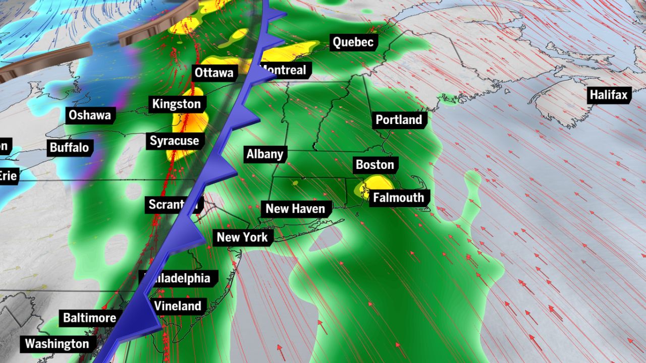
Severe Storms and Cold Front
The intense heat will also bring a threat of severe weather. While isolated storms are possible Tuesday afternoon, a stronger line of thunderstorms is expected on Wednesday.
A fast-moving cold front driving these storms could produce damaging wind gusts and large hail across local neighborhoods before clearing out Wednesday night.
Cool Down Ahead For Memorial Day Weekend
The upcoming cold front will provide dramatic relief from the heat just in time for the holiday weekend.
Temperatures will drop significantly, with highs holding mainly in the 60s starting Thursday. However, local residents should prepare for a damp holiday, as rain is likely on Saturday and could linger into Sunday and Monday.