Boston, Massachusetts — Residents across the Northeast and Great Lakes are bracing for an unusually chilly and damp stretch of weather this week as temperatures plunge below normal and multiple rounds of rain move into the region.
The dramatic cooldown comes while parts of the Southwest continue dealing with triple-digit heat, creating a sharp weather contrast across the United States.
Cooler Temperatures Taking Hold Across Northeast
Meteorologists say temperatures throughout the Ohio Valley, mid-Atlantic, and New England will remain noticeably below historical averages through much of the week.
Cities from Detroit to Boston are expected to see daytime highs running 5 to 10 degrees below normal for mid-May.
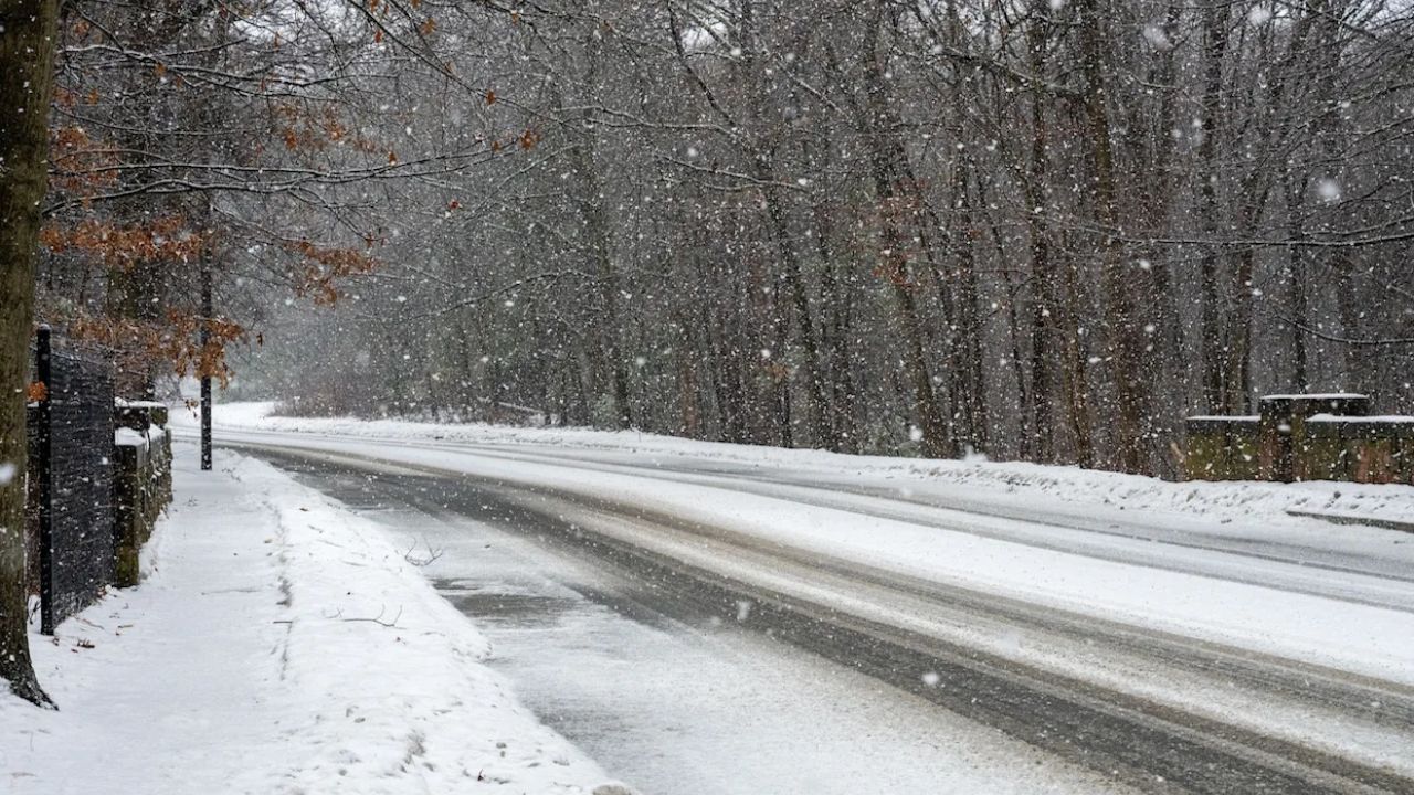
The coldest conditions are forecast late Monday night into early Tuesday morning, when some locations across the Great Lakes and interior Northeast could drop into the 30s.
That could create a risk of frost or even a light freeze, especially in rural and elevated areas.
The sudden cold snap may threaten blooming trees, gardens, and other sensitive plants, which have already started growing due to recent spring warmth.
Rain and Clouds Add to the Chilly Pattern
In addition to cooler temperatures, much of the region is expected to experience several days of gloomy conditions, including thick cloud cover, rain showers, and possible thunderstorms.
Forecasters say the unsettled weather pattern is being driven by dips in the jet stream, which are helping pull cooler Canadian air into the eastern United States.
The combination of chilly air and repeated rainfall could make conditions feel more like early spring than mid-May in many areas.
Storm System Could Trigger Thunderstorms Midweek
A storm system moving across the North Central states and into the Northeast by midweek is expected to slow down and linger near the New England coastline later in the week.
“From mid- to late week, a late-spring, clipperlike system diving south out of central Canada into the Great Lakes and East could spark some gusty thunderstorms across the Northeast and mid-Atlantic,” said meteorologists.
The system may bring periods of heavier rain and isolated thunderstorms to parts of the Northeast and mid-Atlantic region from Wednesday through Friday.
Rainfall Could Help Drought-Stricken Areas
Despite the gloomy conditions, the incoming rain could provide some relief for drought-affected parts of the Northeast.
Areas across Maryland, Virginia, and portions of New England have been experiencing dry conditions in recent weeks.
According to the latest U.S. Drought Monitor, parts of New Hampshire and Maine are currently dealing with extreme drought.
Forecasters believe the best opportunity for meaningful rainfall in New England will likely occur from Wednesday night into Friday, though experts caution that multiple additional rain events would still be needed to significantly improve long-term drought conditions.
The rainfall could also help support agriculture and early-season crops before hotter weather arrives later this month.
Warmer Weather Expected to Return Soon
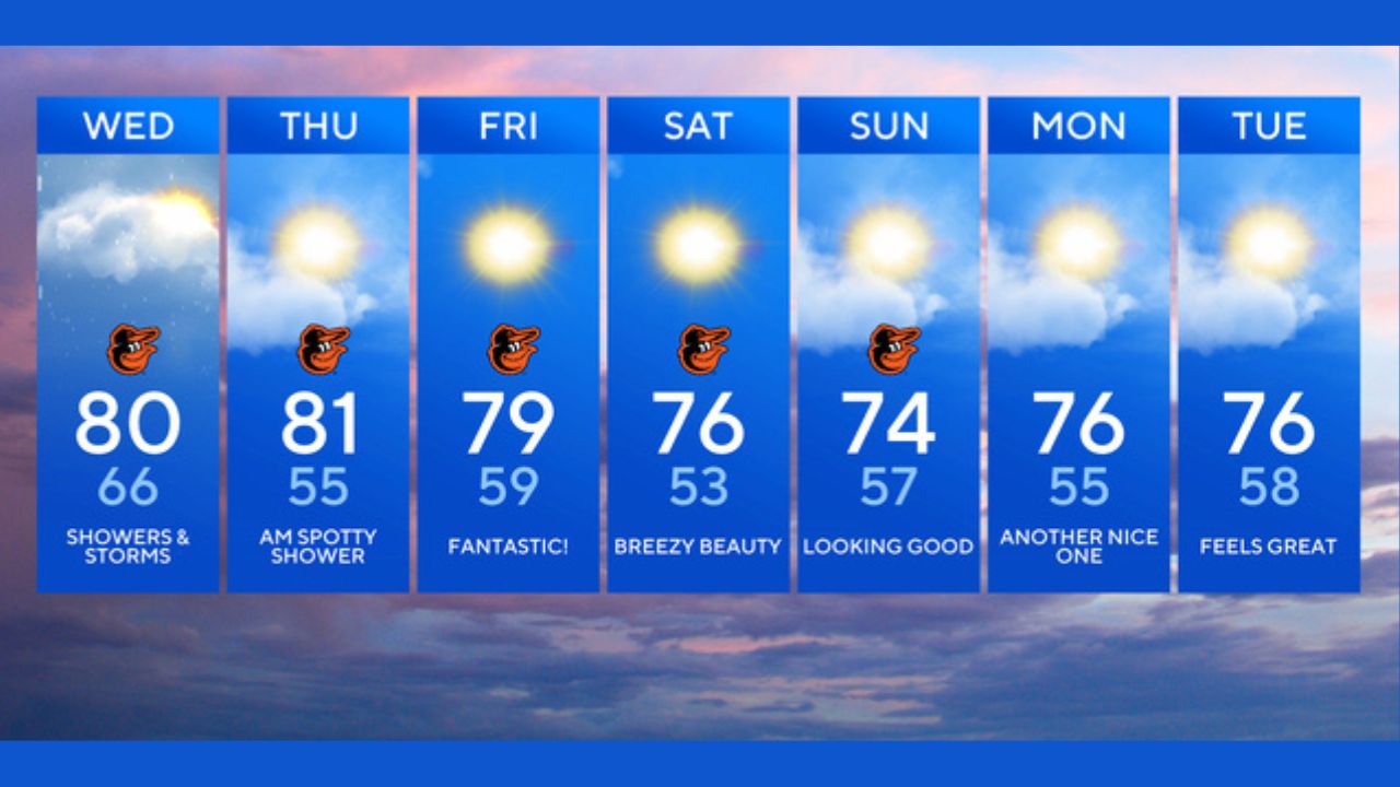
Although the week will remain cool and unsettled, forecasters say relief may arrive by the weekend.
Temperatures are expected to rebound into the 70s and even lower 80s by Saturday and Sunday in many Northeast cities.
Looking further ahead, meteorologists predict a larger pattern shift later in May as the jet stream lifts northward and warmer southern air spreads across the eastern United States.
That change could bring summerlike warmth heading toward Memorial Day, signaling a much different weather pattern for the final weeks of the month.
Until then, residents across the Northeast are being encouraged to prepare for several chilly, wet days before the warmer air finally returns.
Are you ready for this unexpected May cooldown? Share your weather thoughts in the comments below.