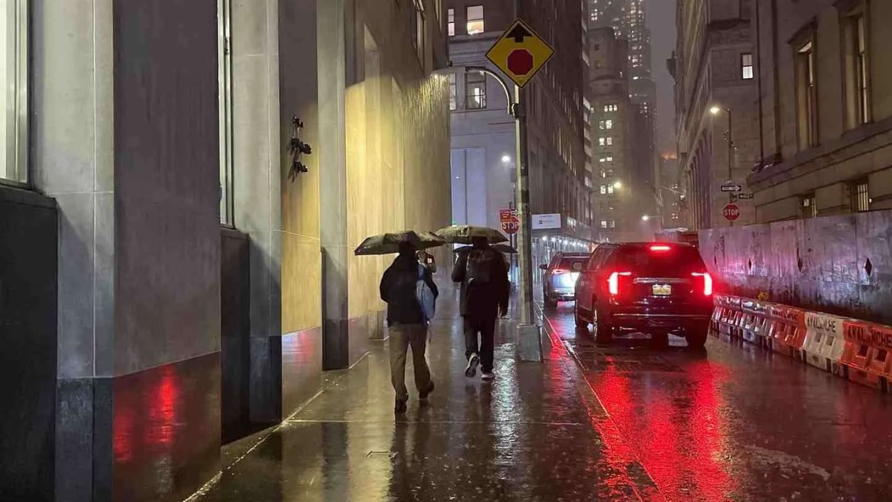
New York City, NY — A damp and gray start greets the city as steady rain moves across New York City this morning, coating streets and slowing traffic through Manhattan, Brooklyn, Queens, the Bronx, and Staten Island. While temperatures remain relatively mild for January, a noticeable shift toward colder, winterlike conditions is expected by Sunday night.
According to the National Weather Service, rain will continue through much of today with highs in the mid-40s. Rainfall totals are expected to range from 0.25 to 0.50 inches, enough to keep roadways slick and visibility reduced at times. Commuters along major routes such as the FDR Drive, Cross Bronx Expressway, and Belt Parkway should allow extra travel time and braking distance.
Rain Tapers, Temperatures Turn Sharper
Rain chances linger into Sunday morning, gradually easing by midday. Skies remain mostly cloudy, with afternoon temperatures hovering in the mid-40s. By Sunday night, winds pick up and colder air pushes into the region, dropping overnight lows into the low 30s.
This temperature drop raises a key concern: refreezing. Pooled water from today’s rain may freeze on untreated roads, sidewalks, and bridges late Sunday night into early Monday, creating isolated black ice, especially during the morning commute.
Early Week Outlook: Cold but Quiet
Monday brings mostly sunny skies but a colder feel, with highs near 40 degrees. Overnight temperatures remain chilly through midweek, generally ranging from the mid-30s to low-40s. No snow is currently expected within the city, though forecasters continue monitoring wintry systems passing north and west of the metro area.
Residents are advised to keep rain gear handy today, dress warmly by Sunday night, and stay alert for slick spots early next week as colder air settles in.
Five-Day Forecast for New York City
- Today: Rain likely, high near 44
- Sunday: Morning rain chance, cloudy, high near 45
- Monday: Mostly sunny, colder, high near 41
- Tuesday: Mostly sunny, high near 44
- Wednesday: Mostly cloudy, high near 48
Weather conditions may continue to evolve as winter tightens its grip across the region. Stay tuned for additional advisories if colder trends intensify.